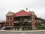
City of Gosnells
1907 establishments in AustraliaCity of GosnellsLocal government areas of the Perth region of Western AustraliaPopulated places established in 1907Use Australian English from April 2018

The City of Gosnells is a local government area in the southeastern suburbs of the Western Australian capital city of Perth, located northwest of Armadale and about 20 kilometres (12 mi) southeast of Perth's central business district. The City covers an area of 128 square kilometres (49.42 sq mi), a portion of which is state forest rising into the Darling Scarp to the east, and had a population of approximately 118,000 at the 2016 Census. The largest activity centre in the City is the Central Maddington shopping centre. District centres exist in the Gosnells town centre and Thornlie.
Excerpt from the Wikipedia article City of Gosnells (License: CC BY-SA 3.0, Authors, Images).City of Gosnells
Terence Street, City Of Gosnells
Geographical coordinates (GPS) Address Nearby Places Show on map
Geographical coordinates (GPS)
| Latitude | Longitude |
|---|---|
| N -32.072 ° | E 115.995 ° |
Address
Terence Street
6109 City Of Gosnells, Gosnells
Western Australia, Australia
Open on Google Maps


