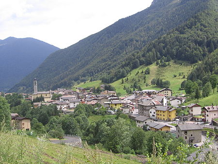
Colere
Cities and towns in LombardyMunicipalities of the Province of BergamoProvince of Bergamo geography stubs

Colere (Bergamasque: Còler) is a comune (municipality) in the Province of Bergamo in the Italian region of Lombardy, located about 90 kilometres (56 mi) northeast of Milan and about 45 kilometres (28 mi) northeast of Bergamo. As of 31 December 2004, it had a population of 1,147 and an area of 18.8 square kilometres (7.3 sq mi).Colere borders the following municipalities: Angolo Terme, Azzone, Castione della Presolana, Rovetta, Vilminore di Scalve.
Excerpt from the Wikipedia article Colere (License: CC BY-SA 3.0, Authors, Images).Colere
X Lazaret 30', Comunità Montana di Scalve
Geographical coordinates (GPS) Address Nearby Places Show on map
Geographical coordinates (GPS)
| Latitude | Longitude |
|---|---|
| N 45.966666666667 ° | E 10.083333333333 ° |
Address
X Lazaret 30'
X Lazaret 30'
24020 Comunità Montana di Scalve
Lombardy, Italy
Open on Google Maps


