Monte Altissimo
Lombardy geography stubsMountains of LombardyMountains of the Alps

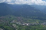
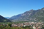
Monte Altissimo is a mountain in the Bergamasque Prealps, with a height of 1,703 metres (5,587 ft). It is located between the lower Val Camonica, the lower Val di Scalve. The Borno plateau divides it from the higher Pizzo Camino. Nearby is the Oglio River.
Excerpt from the Wikipedia article Monte Altissimo (License: CC BY-SA 3.0, Authors, Images).Monte Altissimo
Col de Serf, Comunità montana della valle Camonica
Geographical coordinates (GPS) Address Nearby Places Show on map
Geographical coordinates (GPS)
| Latitude | Longitude |
|---|---|
| N 45.911388888889 ° | E 10.173611111111 ° |
Address
Baita Altissimo
Col de Serf
25040 Comunità montana della valle Camonica
Lombardy, Italy
Open on Google Maps


