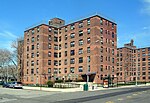
Rockaway, Queens

The Rockaway Peninsula, commonly referred to as The Rockaways or Rockaway, is a peninsula at the southern edge of the New York City borough of Queens on Long Island, New York. Relatively isolated from Manhattan and other more urban parts of the city, Rockaway became a popular summer retreat in the 1830s. It has since become a mixture of lower, middle, and upper-class neighborhoods. In the 2010s, it became one of the city's most quickly gentrifying areas. The peninsula is divided into nine neighborhoods or sections. From east to west, they are: Far Rockaway, from the Nassau County line to Beach 32nd Street; Bayswater, located to the northeast of Far Rockaway, along the southeastern shore of Jamaica Bay Edgemere, from Beach 32nd Street to Beach 56th Street; Arverne, from Beach 56th Street to Beach 79th Street; Rockaway Beach, from 79th Street to Beach 108th Street; Rockaway Park, from Beach 108th Street to Beach 126th Street; Belle Harbor, from Beach 126th Street to Beach 141st Street; Neponsit, Beach 141st Street to Beach 149th Street; Breezy Point, from Beach 149th to the western tip.The peninsula is part of Queens Community District 14 and is patrolled by the 100th and 101st Precincts of the New York City Police Department. As of 2007, the peninsula's total population is estimated to be just below 130,000. All ZIP Codes in Rockaway begin with the three digits 116 and the central post office is in Far Rockaway.
Excerpt from the Wikipedia article Rockaway, Queens (License: CC BY-SA 3.0, Authors, Images).Rockaway, Queens
Rockaway Beach Boulevard, New York Queens County
Geographical coordinates (GPS) Address Nearby Places Show on map
Geographical coordinates (GPS)
| Latitude | Longitude |
|---|---|
| N 40.585833333333 ° | E -73.816944444444 ° |
Address
Rockaway Beach Boulevard
Rockaway Beach Boulevard
11694 New York, Queens County
New York, United States
Open on Google Maps


