place

Cascades Park (Tallahassee)

National Register of Historic Places in Tallahassee, FloridaParks in Tallahassee, FloridaParks on the National Register of Historic Places in FloridaUse mdy dates from August 2023
Cascades Park 2015
Cascades Park 2015

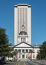
Cascades Park is a 24-acre (97,000 m2) park along the stream known as the St. Augustine Branch in Tallahassee, Florida, south of the Florida State Capitol. It is a Nationally Registered Historic Place because it influenced the territorial government's choice of the capital city's location. It also contains Florida's Prime meridian marker monument which is the foundation point for most land mapping throughout Florida.The park as conceived in 1971 had a stream and shallow waterfalls but it closed because of soil contamination and toxic waste left buried by the gasification plant that once occupied the site. It was cleaned up with Department of Environmental Protection funding in 2006 and construction on the new park was initiated in 2010 using money from the penny sales tax. The newly designed Cascades Park opened in 2014. Features of the new park include the Capital City Amphitheater, a fountain with light, music, splash pads, and ponds, and boulder climbing, beachscape and outdoor classroom area known as Discovery at Cascade Park that was privately funded.

Excerpt from the Wikipedia article Cascades Park (Tallahassee) (License: CC BY-SA 3.0, Authors, Images).

Cascades Park (Tallahassee)
East Gaines Street, Tallahassee

Geographical coordinates (GPS) Address Nearby Places
placeShow on map

Wikipedia: Cascades Park (Tallahassee)Continue reading on Wikipedia

Geographical coordinates (GPS)

Latitude Longitude
N 30.435555555556 ° E -84.277222222222 °
placeShow on map

Address

Coleman Building

East Gaines Street 400
32301 Tallahassee
Florida, United States
mapOpen on Google Maps

Cascades Park 2015
Cascades Park 2015
Share experience

Nearby Places

Tallahassee meridian

The Tallahassee meridian, in longitude 84° 16′ 37.59″ west from the prime meridian at Greenwich, runs north and south from the initial point on the base line at Tallahassee, in latitude 30° 26′ 04.12″ north, and as a principal meridian governs the surveys in Florida and Alabama as part of the Public Land Survey System. The "Tallahassee meridian" survey monument (see survey marker) is located at the intersection of these lines of longitude and latitude (the longitude line being the "Tallahassee meridian" and the latitude line being the "Tallahassee Parallel" or "Tallahassee Base Line"). This survey monument serves as the initial point for U.S. government surveys in the state of Florida. The 6 mile × 6 mile townships originate from here and are numbered by township (see survey township) depending upon whether they are north or south of this point, and are numbered by "range" depending upon whether they are east or west of this point. Thus, Township 3 South Range 26 East would extend from approximately 12 to 18 miles South of the monument, and would be positioned from approximately 150 to 156 miles East of the monument. Each township/range is then divided into 36 sections of 1 mile by 1 mile each. This survey monument can be found in Cascades Park near the amphitheater. The monument originally marked the southwest corner of a section of land given in gratitude by the United States to Marquis de la Fayette (see Lafayette Land Grant) — his lands being part of Township 1 North Range 1 East. Photographs of the marker are published by the Principal Meridian Project (www.pmproject.org ).