place

Smoky Hollow Historic District

Big Bend Region, Florida Registered Historic Place stubsHistoric districts on the National Register of Historic Places in FloridaLeon County, Florida geography stubsNRHP infobox with nocatNational Register of Historic Places in Tallahassee, Florida
Neighborhoods in Tallahassee, FloridaTallahassee, Florida stubsUse mdy dates from August 2023Vernacular architecture in Florida
Smokey Hollow
Smokey Hollow

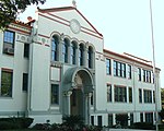
The Smoky Hollow Historic District is a U.S. historic district (designated as such on October 27, 2000) located in Tallahassee, Florida. The district is bounded by East Lafayette Street, CSX RR tracks, Myers Park and Myers Park Lane. It contains 14 historic buildings and 3 structures. On January 14, 2009, a decrease in the district's boundary was implemented.

Excerpt from the Wikipedia article Smoky Hollow Historic District (License: CC BY-SA 3.0, Authors, Images).

Smoky Hollow Historic District
Myers Park Lane, Tallahassee

Geographical coordinates (GPS) Address Nearby Places
placeShow on map

Wikipedia: Smoky Hollow Historic DistrictContinue reading on Wikipedia

Geographical coordinates (GPS)

Latitude Longitude
N 30.436388888889 ° E -84.271944444444 °
placeShow on map

Address

Myers Park Lane 1005
32301 Tallahassee
Florida, United States
mapOpen on Google Maps

Smokey Hollow
Smokey Hollow
Share experience

Nearby Places

DeSoto Site Historic State Park

DeSoto Site Historic State Park is a Florida state park located in Tallahassee, Florida. It consists of 5 acres (20,000 m2) of land near Apalachee Parkway, including the residence of former Governor John W. Martin. The site is intended to initiate research and education on nearly four centuries of recorded history beginning with Hernando de Soto's use of the site as a winter encampment in 1539. There is an exhibit of items found at the site in the Governor Martin House.A 1998 historical marker at the site reads: In 1539, a Spanish expeditionary force led by Hernando de Soto landed in the Tampa Bay area. Nearly 600 heavily armed adventurers traveled more than 4000 miles from Florida to Mexico intending to explore and control the Southeast of North America. The route of de Soto has always been uncertain, including the location of the village of Anhaica, the first winter encampment. The place was thought to be in the vicinity of present day Tallahassee, but no physical evidence had ever been found. Calvin Jones’ chance discovery of 16th century Spanish artifacts in 1987 settled the argument. Jones, a state archaeologist, led a team of amateurs and professionals in an excavation which recovered more than 40,000 artifacts. The evidence includes links of chain mail armor, copper coins, the iron tip of a crossbow bolt, Spanish olive jar shards, and glass trade beads. The team also found the jaw bone of a pig. Pigs were not native to the New World and historical documents confirm that the expedition brought swine. These finds provided the physical evidence of the 1539-40 winter encampment, the first confirmed de Soto site in North America. From this location, the de Soto expedition traveled northward and westward making the first European contact with many native societies. Within two centuries, most of the southeastern native cultures were greatly diminished. This is the site of the First Christmas celebrated in what would be the United States at the Hernando de Soto Winter encampment in 1539.

Tallahassee meridian

The Tallahassee meridian, in longitude 84° 16′ 37.59″ west from the prime meridian at Greenwich, runs north and south from the initial point on the base line at Tallahassee, in latitude 30° 26′ 04.12″ north, and as a principal meridian governs the surveys in Florida and Alabama as part of the Public Land Survey System. The "Tallahassee meridian" survey monument (see survey marker) is located at the intersection of these lines of longitude and latitude (the longitude line being the "Tallahassee meridian" and the latitude line being the "Tallahassee Parallel" or "Tallahassee Base Line"). This survey monument serves as the initial point for U.S. government surveys in the state of Florida. The 6 mile × 6 mile townships originate from here and are numbered by township (see survey township) depending upon whether they are north or south of this point, and are numbered by "range" depending upon whether they are east or west of this point. Thus, Township 3 South Range 26 East would extend from approximately 12 to 18 miles South of the monument, and would be positioned from approximately 150 to 156 miles East of the monument. Each township/range is then divided into 36 sections of 1 mile by 1 mile each. This survey monument can be found in Cascades Park near the amphitheater. The monument originally marked the southwest corner of a section of land given in gratitude by the United States to Marquis de la Fayette (see Lafayette Land Grant) — his lands being part of Township 1 North Range 1 East. Photographs of the marker are published by the Principal Meridian Project (www.pmproject.org ).