place

I Love You Will U Marry Me

Culture in SheffieldGraffiti in EnglandLight art
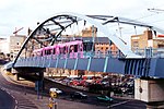
I love you bridge 2022 (cropped)

I Love You Will U Marry Me was a message added as graffiti to a high concrete bridge at the Park Hill housing estate in Sheffield in April 2001, after the estate was listed at Grade II in 1998 and before renovations began in 2006. The slogan was removed due to maintenance work in 2021, but reinstated in 2022.

Excerpt from the Wikipedia article I Love You Will U Marry Me (License: CC BY-SA 3.0, Authors, Images).

I Love You Will U Marry Me
South Street, Sheffield Park Hill

Geographical coordinates (GPS) Address Nearby Places
placeShow on map

Wikipedia: I Love You Will U Marry MeContinue reading on Wikipedia

Geographical coordinates (GPS)

Latitude Longitude
N 53.3804 ° E -1.4593 °
placeShow on map

Address

Park Hill Flats

South Street
S2 2TN Sheffield, Park Hill
England, United Kingdom
mapOpen on Google Maps

I love you bridge 2022 (cropped)
Share experience

Nearby Places

City Goods station
City Goods station

City Goods was a goods station, belonging to the London and North Western Railway, in Sheffield, South Yorkshire, England. The London and North Western Railway presence in Sheffield began in 1895 when it opened a small goods station on Bernard Road. The company opened a ¾-mile branch eastwards from Woodburn Junction to what was then called their Sheffield City Goods terminal on Bernard Road. Its first line in the steel city was inadequate in the eyes of the LNWR as it was buried under its rivals' network of lines. The company obtained powers to build a more suitable establishment. The site chosen was at the corner of Broad Street and Wharf Street, behind the Corn Exchange, ¾ mile west of their terminus on Bernard Road. A tunnel under the Nunnery Colliery goods line was necessary as well as a bridge above the Midland Main Line (MML), just north of Midland station. The exit of the tunnel was directly above the MML and connected to a bridge above the main railway line. It then continued west to the depot on red brick arches. The depot building itself was three storeys high and covered 94,260 ft²; it possessed two 20-ton hydraulic lifts capable of carrying 10-ton wagons down to the basement (actually at street level). The yard opened in February 1903 and Bernard Road depot was kept open to deal with heavier loads. To avoid confusion, Bernard Road goods was renamed Nunnery Goods and the title of City Goods passed on to the new goods yard. The depot closed on 12 July 1965 when a large new freight transshipment and engine depot opened at Grimesthorpe.

Castlegate Quarter
Castlegate Quarter

The Castlegate Quarter is one of the eleven quarters of Sheffield city centre. It is named after Castlegate, the quarter's main thoroughfare. The boundaries of the Castlegate Quarter are formed by Castlegate and the River Don to the north, Exchange Place to the east, Commercial Street and part of the High Street to the south, and Angel Street and Snig Hill to the west. For the latter part of the 20th century, the Castlegate Quarter was dominated by Castle Market, a large indoor market building. Following the demolition of Castle Market in 2015, the quarter is now undergoing regeneration as of 2020. The quarter's eponymous road, Castlegate, was originally part of the main thoroughfare from the city centre to the north of the city, linking Park Square to The Wicker; however, the completion of the Sheffield Northern Relief Road dual-carriageway in 2007 redirected traffic away from the Castlegate area, and the road was downgraded. Castlegate was built along the southern bank of the River Don along the north side of what was once Sheffield Castle, and was originally the location of several slaughterhouses. It has also subsequently served as a back entrance to the Alexandra Opera House and then the Castle Market, which was constructed in the 1960s to provide permanent accommodation to tradesmen. Castle Market closed in November 2013 with the opening of the Moor Markets across the city centre, and demolition of Castle Market commenced in 2015. The foundations of the old Sheffield Castle, from which the area takes its name, were rediscovered following the demolition of the market building. In August 2018, archaeologists began excavations of the castle foundations in order to return them to public view for the first time in hundreds of years. Sheffield City Council subsequently invested £5 million as part of Grey to Green Phase Two, a regeneration plan for the Castlegate Quarter following the closure of the market, which includes removing the River Sheaf from its culvert close to its confluence with the River Don and creating a new riverside park incorporating the castle ruins. As part of the scheme, Castlegate was pedestrianised and its bus stops were relocated onto surrounding roads. In October 2021, Sheffield City Council was awarded 'levelling up' funding for the deculverting of the River Sheaf and the restoration of the former Castle site into a city centre park.

Cholera Monument Grounds and Clay Wood

The Cholera Monument is a memorial in Sheffield, England, to the victims of a cholera epidemic of 1832. Of the 402 victims of the disease 339 were buried in grounds between Park Hill and Norfolk Park adjoining Clay Wood. Money from the treasurers of the Board of Health was set aside for a monument for the site. The monument was designed by M. E. Hadfield, sculpted by Earp and Hobbs and completed in 1835. It is a neo-Gothic pinnacle and has a plaque naming John Blake, Master Cutler in 1832 and a victim of the epidemic and noting that the foundation stone was laid by the poet James Montgomery. The monument is situated in gardens laid out around the monument in the 1850s and next to Clay Wood, an ancient woodland. These were given to the city by the Duke of Norfolk in 1930. A shaded path laid between 1971 and 1995 traverses the woods from Fitzwalter Road to the monument gardens. The monument was struck by lightning in 1990 and the top removed for safety. Rebuilding began in 2005 thanks to a grant, and was completed in 2006. Restorer Jim Hurley and his team received the 2006 Marsh Award for Excellence in Public Sculpture for their work.A clay cobbled mound art installation was erected in 2004, representing the individuals who died. September 2014 saw the official opening of a 'green link', providing paths and cycle ways between Norfolk Heritage Park and the city centre. The route included the Cholera Monument Grounds, opening up the north-western corner of the grounds which overlook the city centre, and providing a direct link from the monument to Shrewsbury Road. The monument is grade II listed, while the grounds are a conservation area which has received a Green Flag Award.