place

Northamptonshire

Counties of England established in antiquityEast MidlandsEngvarB from July 2014Northamptonshire
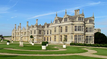
Kirby Hall (9972807555)

Northamptonshire (; abbreviated Northants.) is a ceremonial county in the East Midlands of England. It is bordered by Leicestershire, Rutland, and Lincolnshire to the north, Cambridgeshire to the east, Bedfordshire, Buckinghamshire, Oxfordshire to the south, and Warwickshire to the west. Northampton is the largest settlement and the county town. The county has an area of 2,364 km2 (913 sq mi) and a population of 747,622. The latter is concentrated in the centre of the county, which contains the county's largest towns: Northampton (243,511), Corby (68,164), Kettering (63,144), and Wellingborough (56,564). The northeast and southwest are rural. The county contains two local government districts, North Northamptonshire and West Northamptonshire, which are both unitary authority areas. The county historically included Market Harborough and the Soke of Peterborough. The county is characterised by low, undulating hills, particularly to the west. They are the source of several rivers, including the Avon and Welland, which form much of the northern border; the Cherwell; and the Great Ouse. The River Nene is the principal river wihin the county, having its source in the southwest and flowing northeast past Northampton and Wellingborough. The highest point is Arbury Hill southwest of Daventry, at 225 m (738 ft). There are Iron Age and Roman remains in the county, and in the seventh century it was settled by the Angles and Saxons, becoming part of Mercia. The county likely has its origin in the Danelaw as the area controlled from Northampton, which was one of the Five Boroughs. In the later Middle Ages and Early Modern Period the county was relatively settled, although Northampton was the location of engagements during the First and Second Barons' Wars and the Wars of the Roses, and during the First English Civil War Naseby was the site of a decisive battle which destroyed the main Royalist army. During the Industrial Revolution Northamptonshire became known for its footwear, and the contemporary county has a number of small industrial centres which specialise in engineering and food processing.

Excerpt from the Wikipedia article Northamptonshire (License: CC BY-SA 3.0, Authors, Images).

Northamptonshire
Billing Lane,

Geographical coordinates (GPS) Address Nearby Places
placeShow on map

Wikipedia: NorthamptonshireContinue reading on Wikipedia

Geographical coordinates (GPS)

Latitude Longitude
N 52.283333333333 ° E -0.83333333333333 °
placeShow on map

Address

Billing Lane

Billing Lane
NN3 5DB , Overstone
England, United Kingdom
mapOpen on Google Maps

Kirby Hall (9972807555)
Share experience

Nearby Places

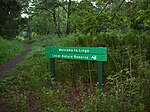
List of local nature reserves in Northamptonshire

Northamptonshire is a county in the East Midlands of England. It has an area of 236,700 hectares (914 sq mi) and a population estimated in mid-2015 at 723,000. It is bordered by Warwickshire, Leicestershire, Rutland, Lincolnshire, Cambridgeshire, Bedfordshire, Buckinghamshire and Oxfordshire. It was governed by Northamptonshire County Council and seven district and borough councils, Corby, Daventry, East Northamptonshire, Kettering, Northampton, South Northamptonshire and Wellingborough until April 2021 when North Northamptonshire and West Northamptonshire unitary authorities were formed. The county flower is the cowslip.A ridge of low Jurassic hills runs through the county, separating the basins of the Welland and Nene rivers. The county has good communications as it is crossed by two main railway lines and the M1 motorway, and it has many small industrial centres rather than large conurbations. The main architectural feature is its country houses and mansions.As of May 2017, there are 18 local nature reserves in Northamptonshire, and there is public access to all sites. Twelve are managed by the Wildlife Trust for Bedfordshire, Cambridgeshire and Northamptonshire, and two are also Sites of Special Scientific Interest, Ramsar internationally important wetland sites, and Special Protection Areas under the European Union Directive on the Conservation of Wild Birds. The largest site is Titchmarsh Nature Reserve at 72.7 hectares (180 acres), which has nationally important numbers of goosanders, wigeons and gadwalls in winter. The smallest is Great Oakley Meadow, which has prominent surviving ridge and furrow from the medieval ploughing system.

Moulton School and Science College

Moulton School & Science College is a secondary school with academy status located in the village of Moulton, Northamptonshire. Formerly known as Moulton School, the founding headmaster was Leslie Alfred Scott (1914-1999), who was headmaster from 1954 until his retirement in 1979. He established the school motto - "Fill the Unforgiving Minute". He also established the first house system (Hilary, Bannister, Fleming and Whittle) and created the school crest. Two new houses were added, Scott and Petit, after Scott retired in 1979. As of 2019, the school as of 2019 had 1,355 students on roll, including in the sixth form, and 135 teachers. It is a school for ages 11–18. The school was granted specialist Science College status in 2002, and this was re-designated in 2007.The acting headteacher, as of March 2021, is Angie Dabbs. The school used to separate the students into four different houses named after the Northamptonshire houses of Holdenby House, Althorp, Rockingham, and Sulgrave Manor. They had different colour ties to represent them: blue for Althorp, green for Holdenby, red for Rockingham and yellow for Sulgrave, but since the 2012–13 academic year, the school has year groups consisting of eight classes per year, instead of houses. The colours for each year are rotated. As of 2022, The year colours are as follows. Gold (Year 7) , Blue (Year 8) , Green (Year 9) , Black (Year 10) Silver (Year 11). They rotate every year.As of 2022, The houses have been renamed to Hunsbury (Green), Ravensthorpe (Red), Stanwick (Yellow) and Barnwell (Blue). The school serves students from Moulton, Pitsford, Boughton, Brixworth, Chapel Brampton, Church Brampton, Old, Kingsthorpe, Walgrave, Harlestone, Rectory Farm, Holcot and Sywell.In June 2013, it received a "Good" report from Ofsted. which was confirmed in 2017.