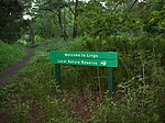
List of local nature reserves in Northamptonshire

Northamptonshire is a county in the East Midlands of England. It has an area of 236,700 hectares (914 sq mi) and a population estimated in mid-2015 at 723,000. It is bordered by Warwickshire, Leicestershire, Rutland, Lincolnshire, Cambridgeshire, Bedfordshire, Buckinghamshire and Oxfordshire. It was governed by Northamptonshire County Council and seven district and borough councils, Corby, Daventry, East Northamptonshire, Kettering, Northampton, South Northamptonshire and Wellingborough until April 2021 when North Northamptonshire and West Northamptonshire unitary authorities were formed. The county flower is the cowslip.A ridge of low Jurassic hills runs through the county, separating the basins of the Welland and Nene rivers. The county has good communications as it is crossed by two main railway lines and the M1 motorway, and it has many small industrial centres rather than large conurbations. The main architectural feature is its country houses and mansions.As of May 2017, there are 18 local nature reserves in Northamptonshire, and there is public access to all sites. Twelve are managed by the Wildlife Trust for Bedfordshire, Cambridgeshire and Northamptonshire, and two are also Sites of Special Scientific Interest, Ramsar internationally important wetland sites, and Special Protection Areas under the European Union Directive on the Conservation of Wild Birds. The largest site is Titchmarsh Nature Reserve at 72.7 hectares (180 acres), which has nationally important numbers of goosanders, wigeons and gadwalls in winter. The smallest is Great Oakley Meadow, which has prominent surviving ridge and furrow from the medieval ploughing system.
Excerpt from the Wikipedia article List of local nature reserves in Northamptonshire (License: CC BY-SA 3.0, Authors, Images).List of local nature reserves in Northamptonshire
Billing Lane,
Geographical coordinates (GPS) Address Nearby Places Show on map
Geographical coordinates (GPS)
| Latitude | Longitude |
|---|---|
| N 52.283333333333 ° | E -0.83333333333333 ° |
Address
Billing Lane
Billing Lane
NN3 5DB , Overstone
England, United Kingdom
Open on Google Maps


