place

Arlington Peak (California)

Mountains of Santa Barbara County, CaliforniaMountains of Southern CaliforniaSanta Barbara County, California geography stubsSanta Ynez Mountains
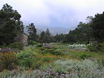
SantaBarbaraCA ArlingtonPeakFromSkofield 20170911

Arlington Peak is a 3,258-foot (993 m) high peak within the Santa Ynez Mountains located north of Santa Barbara, California, adjacent to the south of La Cumbre Peak and to the southeast of Cathedral Peak. The name of the peak purportedly originated in 1889 from the staff of the Arlington Hotel who referred to the area comprising the three peaks as The Arlington Crags. Arlington Peak was officially named in 2004 by the United States Board on Geographic Names.The peak is accessible via a 4.1-mile (7 km) "out and back" trail used for hiking and rock climbing, which is rated as difficult. There have been occasional incidents where hikers were injured and required evacuation.

Excerpt from the Wikipedia article Arlington Peak (California) (License: CC BY-SA 3.0, Authors, Images).

Arlington Peak (California)
Cathedral Peak Trail,

Geographical coordinates (GPS) Address Nearby Places
placeShow on map

Wikipedia: Arlington Peak (California)Continue reading on Wikipedia

Geographical coordinates (GPS)

Latitude Longitude
N 34.48277 ° E -119.71458 °
placeShow on map

Address

Cathedral Peak Trail

Cathedral Peak Trail
93105
California, United States
mapOpen on Google Maps

SantaBarbaraCA ArlingtonPeakFromSkofield 20170911
Share experience

Nearby Places

La Cumbre Peak
La Cumbre Peak

La Cumbre Peak is a 3,997-foot (1,218 m) peak in the Santa Ynez Mountains north of Santa Barbara, California and located within the Los Padres National Forest. Composed of boulders and slabs of the Matilija Sandstone amid groves of pine trees, it is the highest summit in proximity to the city. Adjacent to La Cumbre is Arlington Peak (3,258 ft (993 m)) and Cathedral Peak (3,336 ft (1,017 m)). Other peaks within the Santa Ynez Range include Santa Ynez Peak, 15 miles (24 km) to the west, and Divide Peak, 15 miles (24 km) to the east. East Camino Cielo (originally known as Ridge Route) was constructed between October 1930 and June 1931 as a single lane road that extended 18 miles (29 kilometres) from San Marcos Pass to the summit of La Cumbre Peak. The intermittently curvaceous road was opened to the public, built with frequent turnouts and a set maximum speed limit of 15 mi (24 km) per hour. Today the road is frequently used by runners and cyclists for training, as the elevation gain is substantial and sustained, while there is relatively little car traffic. Construction of a fire lookout station upon the summit featuring a seasonal glass house was completed in the summer of 1923 by the US Forest Service, but may have been impacted by a fire that approached it from three sides in September of that year. In 1946, "La Cumbre Peak Lookout" was built to replace a California Region 5 Plan 4AR cabin that was mounted on a 10 ft (3.0 m) open timber tower. Utilizing an "innovative experimental design" that employed relatively high walls and sloped glass, the newer structure was considered to be expensive for its time (at a cost of $6,500) and was therefore the only model of its type to be constructed. The lookout was listed in the National Historic Lookout Register on June 19, 2010.