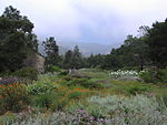
Jesusita Fire
2009 California wildfiresHistory of Santa Barbara County, CaliforniaSanta Ynez MountainsWildfires in Santa Barbara County, California

The Jesusita Fire was a wildfire that started on May 5, 2009, in the hills of Santa Barbara, California in the western United States. By the time the fire was contained on May 18 it had burned 8,733 acres (35.34 km2), destroyed 80 homes and damaged 15 more before being 100% contained. The cause of the fire was ultimately traced to local contractors who had left gas cans and hot equipment unattended in dry brush after clearing part of the Jesusita Trail using a weed wacker without any permits or the permission of the landowner.
Excerpt from the Wikipedia article Jesusita Fire (License: CC BY-SA 3.0, Authors, Images).Jesusita Fire
Ben Lomond Drive,
Geographical coordinates (GPS) Address Nearby Places Show on map
Geographical coordinates (GPS)
| Latitude | Longitude |
|---|---|
| N 34.45 ° | E -119.717 ° |
Address
Ben Lomond Drive 2821
93105
California, United States
Open on Google Maps


