place

San Roque, Santa Barbara, California

Geography of Santa Barbara County, CaliforniaSanta Barbara, CaliforniaSanta Barbara County, California geography stubs

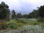
San Roque (Spanish for "Saint Roch") is a primarily residential neighborhood in Santa Barbara, California, located northwest of downtown. For planning purposes, the City of Santa Barbara uses two designations for this area, San Roque and East San Roque. The area takes its name from San Roque creek, which was named by early Spanish settlers after Saint Roch. A rural farming area until the 20th century, San Roque's first residential subdivision was developed in 1917 by Stephen Rutherford and called Rutherford Park. The streets were laid out in an irregular grid transected by spokes from a central circular street, Argonne Circle. Argonne Circle was named in memory of Rutherford's son, Lawrie, who died in the WWI battle of the Argonne forest. In 1926, plans were approved for the San Roque Country Club and golf course to occupy much of the area adjacent to Rutherford Park, but development stalled due to the Great Depression and in 1939 portions of the unbuilt golf course land were donated to the city of Santa Barbara to become San Roque Park and Stevens Park. In 1928, Peabody Elementary School was built in San Roque in response to population growth, and in 1937 the parochial San Roque School was established. Between 1945 and 1970, residential development filled in the remaining unbuilt lots, and commercial development spread along State St. bordering San Roque.

Excerpt from the Wikipedia article San Roque, Santa Barbara, California (License: CC BY-SA 3.0, Authors).

San Roque, Santa Barbara, California
Argonne Circle, Santa Barbara

Geographical coordinates (GPS) Address Nearby Places
placeShow on map

Wikipedia: San Roque, Santa Barbara, CaliforniaContinue reading on Wikipedia

Geographical coordinates (GPS)

Latitude Longitude
N 34.4442 ° E -119.7309 °
placeShow on map

Address

Argonne Circle 3126
93105 Santa Barbara
California, United States
mapOpen on Google Maps

Share experience

Nearby Places

Santa Barbara Mission-Archive Library

The Santa Barbara Mission Archive-Library was founded in 1967 as an independent, non-profit educational and research institution. The collection of mission documents in the archive-library remain in situ from the founding of the mission system. The collections include named sections, the Junipero Serra Collection (1713-1947), the California Mission Documents (1640-1853), and the Apostolic College collection (1853-1885). The archive-library also has a large collection of early California writings, maps, and images as well as a collection of materials for the Tohono O'odham Indians of Arizona. The institution holds several thousand photo images of various types covering a broad range of subjects and dating back to the late nineteenth century. Their collections also contain nineteenth-century oil paintings of the California missions by Edwin DeakinSBMAL is the archival repository for registers in which the sacraments of baptism, marriage, and burial were recorded at the California missions. There are mission records from Mission San Diego de Alcalá; Mission San Carlos Borromeo de Carmelo; Mission San Antonio de Padua; Mission San Gabriel Arcángel; Mission San Luis Obispo de Tolosa; Mission San Francisco de Asís (Dolores); Mission San Juan Capistrano; Mission Santa Clara de Asís; Mission San Buenaventura; Mission Santa Bárbara (including Mission, Presidio, and Our Lady of Sorrows); Mission La Purísima Concepción; Mission Santa Cruz; Mission Nuestra Señora de la Soledad; Mission San Juan Bautista; Mission San Miguel Arcángel; Mission San Fernando Rey de España; Mission San Luis Rey de Francia; Mission Santa Inés; Mission San Rafael Arcángel; Mission San Francisco de Solano; Plaza—Los Angeles