Yacolt Burn State Forest
Use mdy dates from October 2022Washington (state) protected area stubsWashington (state) state forests

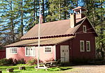
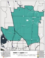
Yacolt Burn State Forest is a 90,000 acre state forest located in southern Washington in the foothills of the Cascade Range. It is named after the Yacolt Burn, a collection of wildfires that broke out in 1902. The Washington State Department of Natural Resources manages the land for timber harvesting and recreation.Long-term ecological research is conducted within a portion of the forest called Abby Road.
Excerpt from the Wikipedia article Yacolt Burn State Forest (License: CC BY-SA 3.0, Authors, Images).Yacolt Burn State Forest
L-1300 Road,
Geographical coordinates (GPS) Address Nearby Places Show on map
Geographical coordinates (GPS)
| Latitude | Longitude |
|---|---|
| N 45.762439 ° | E -122.33032 ° |
Address
L-1300 Road
L-1300 Road
Washington, United States
Open on Google Maps


