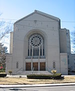
Humewood–Cedarvale

Humewood–Cedarvale is an area of Toronto, Ontario, Canada, consisting of the lower middle class to wealthy Cedarvale in the north and the lower to upper middle class Humewood in the south, divided by Vaughan Road and Cedarvale Ravine. The neighbourhood is bordered by Bathurst Street on the east, Eglinton Avenue to the north, Arlington Avenue to the west, and St. Clair Avenue to the south. Humewood has also been known as "the Woods" because of its many streets that have names ending with "-wood", including Wychwood, Humewood, Cherrywood, Valewood, Maplewood, Wellwood, Kenwood, and Pinewood. The neighbourhood's main commercial areas are along St. Clair Ave. W., referred to as Hillcrest Village and along Eglinton Ave. W..
Excerpt from the Wikipedia article Humewood–Cedarvale (License: CC BY-SA 3.0, Authors, Images).Humewood–Cedarvale
Heathdale Road, Toronto York
Geographical coordinates (GPS) Address Nearby Places Show on map
Geographical coordinates (GPS)
| Latitude | Longitude |
|---|---|
| N 43.691111111111 ° | E -79.425833333333 ° |
Address
Heathdale Road 54
M6C 4B3 Toronto, York
Ontario, Canada
Open on Google Maps


