West Tofts
AC with 0 elementsBreckland DistrictForcibly depopulated communities in the United Kingdom during World War IIFormer populated places in NorfolkGhost towns in England ... and 2 more
Norfolk geography stubsVillages in Norfolk

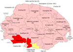
West Tofts is a deserted village located in civil parish of Lynford in the English county of Norfolk. The village became deserted when it was taken over by the British Army during the Second World War as part of the Stanford Battle Area, an infantry training area that is still in use today. The village and most of the parish are within a prohibited area and access is not allowed without special permission from the Army.[1]
Excerpt from the Wikipedia article West Tofts (License: CC BY-SA 3.0, Authors, Images).West Tofts
Stanford Road, Breckland District Lynford
Geographical coordinates (GPS) Address Website Nearby Places Show on map
Geographical coordinates (GPS)
| Latitude | Longitude |
|---|---|
| N 52.500333333333 ° | E 0.70433333333333 ° |
Address
Saint Mary
Stanford Road
IP26 5EW Breckland District, Lynford
England, United Kingdom
Open on Google Maps


