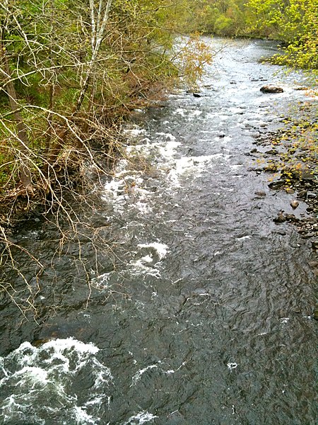
Naugatuck River
Connecticut placenames of Native American originNaugatuck River ValleyRivers of ConnecticutRivers of New Haven County, ConnecticutTributaries of Housatonic River

The Naugatuck River is a 40.2-mile-long (64.7 km) river in the U.S. state of Connecticut. Its waters carve out the Naugatuck River Valley in the western reaches of the state, flowing generally due south and eventually emptying into the Housatonic River at Derby, Connecticut and thence 11 miles (18 km) to Long Island Sound. The Plume and Atwood Dam in Thomaston, completed in 1960 following the Great Flood of 1955, creates a reservoir on the river and is the last barrier to salmon and trout migrating up from the sea.
Excerpt from the Wikipedia article Naugatuck River (License: CC BY-SA 3.0, Authors, Images).Naugatuck River
Commerce Street,
Geographical coordinates (GPS) Address Nearby Places Show on map
Geographical coordinates (GPS)
| Latitude | Longitude |
|---|---|
| N 41.313611111111 ° | E -73.080555555556 ° |
Address
Commerce Street
06418
Connecticut, United States
Open on Google Maps


