place

Seething Lane

Streets in the City of London
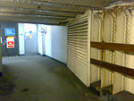
Seething Lane, London EC3 geograph.org.uk 1077513

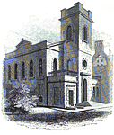
Seething Lane is a street in the City of London. It connects All Hallows-by-the-Tower, Byward Street, with St Olave's Church, Hart Street. The street is named after an Old English expression meaning "full of chaff", which was derived from the nearby corn market in Fenchurch Street. Samuel Pepys lived there and is buried in St Olave's Church at the junction with Hart Street. A bust of Pepys, created by Karin Jonzen, sits in the public garden at the south end of the street.

Excerpt from the Wikipedia article Seething Lane (License: CC BY-SA 3.0, Authors, Images).

Seething Lane
Seething Lane, City of London

Geographical coordinates (GPS) Address Phone number Website Nearby Places
placeShow on map

Wikipedia: Seething LaneContinue reading on Wikipedia

Geographical coordinates (GPS)

Latitude Longitude
N 51.510555555556 ° E -0.079166666666667 °
placeShow on map

Address

The Lampery

Seething Lane 1
EC3N 4AX City of London
England, United Kingdom
mapOpen on Google Maps

Phone number

call+442079779500

Website
apexhotels.co.uk

linkVisit website

Seething Lane, London EC3 geograph.org.uk 1077513
Share experience

Nearby Places

London Wall
London Wall

The London Wall was a defensive wall first built by the Romans around the strategically important port town of Londinium in c. AD 200. It has origins as an initial mound wall and ditch from c. AD 100 and an initial fort, now called Cripplegate fort after the city gate (Cripplegate) that was positioned within its northern wall later on, built in 120-150 where it was then expanded upon by Roman builders into a city-wide defence. Over time, as Roman influence waned through the departure of the Roman army in c. 410, their withdrawal led to its disrepair, as political power on the island dispersed through the Heptarchy (seven kingdoms) period of Anglo-Saxon England. From the conquest of William the Conqueror, successive medieval restorations and repairs to its use have been undertaken. This wall largely defined the boundaries of the City of London until the later Middle Ages, when population rises and the development of towns around the city blurred the perimeter.Events such as the Wars of the Roses also played a part in the wall's development. This can be seen upon fragments of wall in the distinctive bricks used to increase its height through the diaper pattern bricks characteristic of the Tudor period and added crenellated battlements. Throughout its existence, the wall has served multiple purposes such as fortification, controlling the population, and acting as a ceremonial boundary for the city. From the 18th century onward, the expansion of the City of London saw large parts of the wall demolished, including its city gates, to improve traffic flow; or incorporated into new or existing buildings. Over time, parts of the wall have been lost through this development, although archeological and conservation efforts from the Second World War onward have helped to preserve sections of the city wall as scheduled monuments. Like most other city walls around England, and unlike rare examples such as York, the London Wall largely no longer exists, most of its foundations and/or surviving structures having been either buried underground or removed. Its existence, though, can still be seen through a number of uncovered and/ or preserved structures, records (see interactive map), and within modern urban architecture like the London Wall Road that echos the perimeter of the northern section of the London Wall. See source Wikidata query. See this map in big, interactive, with illustrations and more

Fenchurch Street railway station

Fenchurch Street railway station, also known as London Fenchurch Street, is a central London railway terminus in the southeastern corner of the City of London. It takes its name from its proximity to Fenchurch Street, a key thoroughfare in the City. The station and all trains are operated by c2c. Services run on lines built by the London and Blackwall Railway (L&BR) and the London, Tilbury and Southend Railway (LTSR) to destinations in east London and south Essex, including Upminster, Grays, Basildon, Southend and Shoeburyness. The station opened in 1841 to serve the L&BR and was rebuilt in 1854 when the LTSR, a joint venture between the L&BR and the Eastern Counties Railway (ECR), began operating. The ECR also operated trains out of Fenchurch Street to relieve congestion at its other London terminus at Bishopsgate. In 1862 the Great Eastern Railway was created by amalgamating various East Anglian railway companies (including the ECR) and it shared the station with the LTSR until 1912, when the latter was bought by the Midland Railway. The station came under ownership of the London & North Eastern Railway (LNER) following the Railways Act 1921, and was shared by LNER and London Midland & Scottish Railway (LMS) services until nationalisation in 1948. The line from the station was electrified in 1961, and closed for seven weeks in 1994. Fenchurch Street is one of the smallest railway terminals in London in terms of platforms, but one of the most intensively operated. It has no direct interchange with the London Underground. Plans to connect it stalled in the early 1980s because of the lack of progress on the Jubilee line, but it is close to Tower Hill on the Underground and to Tower Gateway on the Docklands Light Railway.