Ardudwy
BarmouthCommotes of GwyneddCommotes of SnowdoniaDyffryn ArdudwyFfestiniog ... and 12 more
GanllwydHarlechLlanbedrLlanelltydLlanfair, GwyneddLlanfrothenMaentwrogPages with Welsh IPAPenrhyndeudraethTalsarnauTrawsfynyddUse British English from February 2018

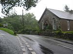
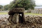
Ardudwy (Welsh pronunciation: [arˈdɨ̞duːɨ̯]) is an area of Gwynedd in north-west Wales, lying between Tremadog Bay and the Rhinogydd. Administratively, under the old Kingdom of Gwynedd, it was first a division of the sub kingdom (cantref) of Dunoding and later a commote in its own right. The fertile swathe of land stretching from Barmouth to Harlech was historically used as pasture. The name exists in the modern community and village of Dyffryn Ardudwy.
Excerpt from the Wikipedia article Ardudwy (License: CC BY-SA 3.0, Authors, Images).Ardudwy
Track to Foel Wen Mine,
Geographical coordinates (GPS) Address Nearby Places Show on map
Geographical coordinates (GPS)
| Latitude | Longitude |
|---|---|
| N 52.803 ° | E -4.04 ° |
Address
Track to Foel Wen Mine
LL45 2PL , Llanbedr
Wales, United Kingdom
Open on Google Maps


