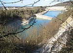
Kingston Blount
Oxfordshire geography stubsUse British English from August 2015Villages in Oxfordshire

Kingston Blount is a village about 4 miles (6.4 km) southeast of Thame in South Oxfordshire, England. The village is a spring line settlement at the foot of the Chiltern Hills escarpment. The ancient pre-Roman Ridgeway and Icknield Way pass through the parish. The Ridgeway is now a National Trail.
Excerpt from the Wikipedia article Kingston Blount (License: CC BY-SA 3.0, Authors, Images).Kingston Blount
High Street, South Oxfordshire
Geographical coordinates (GPS) Address Nearby Places Show on map
Geographical coordinates (GPS)
| Latitude | Longitude |
|---|---|
| N 51.689 ° | E -0.931 ° |
Address
High Street
High Street
OX39 4RT South Oxfordshire
England, United Kingdom
Open on Google Maps


