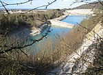
Crowell, Oxfordshire

Crowell is a village and civil parish in Oxfordshire, about 4 miles (6.4 km) southeast of the market town of Thame and 1 mile (1.6 km) southwest of the village of Chinnor. The 2001 Census recorded the parish's population as 100. Crowell village is a spring line settlement at the source of a stream called the Pleck at the foot of the Chiltern Hills escarpment. The toponym "Crowell" is derived from the Old English for "crow's spring" or "crow's stream".Crowell is a strip parish about 3 miles (5 km) long on a northwest – southeast axis and less than 1⁄2-mile (800 m) wide at its widest point. The northwest part of the strip is low-lying land in the Vale of Oxford about 350 feet (110 m) above sea level; the southeast part of the strip is in the Chilterns and rises to 774 feet (236 m) above sea level. The southeastern part of the parish is bounded on three sides by Buckinghamshire.
Excerpt from the Wikipedia article Crowell, Oxfordshire (License: CC BY-SA 3.0, Authors, Images).Crowell, Oxfordshire
Chinnor Road, South Oxfordshire
Geographical coordinates (GPS) Address Nearby Places Show on map
Geographical coordinates (GPS)
| Latitude | Longitude |
|---|---|
| N 51.691 ° | E -0.925 ° |
Address
Saint Mary
Chinnor Road
OX39 4RG South Oxfordshire
England, United Kingdom
Open on Google Maps


