place

Shockoe Hill African Burying Ground

African-American cemeteries in VirginiaAfrican-American history in Richmond, VirginiaCemeteries in Richmond, VirginiaCemeteries on the National Register of Historic Places in VirginiaHistory of Richmond, Virginia
History of slavery in VirginiaNational Register of Historic Places in Richmond, VirginiaNational Register of Historic Places in Virginia by cityUse mdy dates from August 2023
Shockoe Hill African Burying Ground

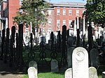
The Shockoe Hill African Burying Ground (Richmond's 2nd African Burial Ground) was established by the city of Richmond, Virginia, for the interment of free people of color, and the enslaved. The heart of this now invisible burying ground is located at 1305 N 5th St. It was created as the replacement for the Burial Ground for Negroes, now also called the Shockoe Bottom African Burial Ground, (or African Burial Ground in Shockoe Bottom). Shockoe Bottom was known historically as Shockoe Valley. The Burial Ground for Negroes was closed in 1816 upon the opening of this new African Burying Ground on Shockoe Hill. The Shockoe Hill African Burying Ground is one of Virginia's most endangered historic places. Major threats to the burial ground are the DC2RVA high-speed rail project, the east-west Commonwealth Corridor, as well as the proposed widening of I-64, and various infrastructure projects.

Excerpt from the Wikipedia article Shockoe Hill African Burying Ground (License: CC BY-SA 3.0, Authors, Images).

Shockoe Hill African Burying Ground
North 5th Street, Richmond Gilpin Court

Geographical coordinates (GPS) Address Website External links Nearby Places
placeShow on map

Wikipedia: Shockoe Hill African Burying GroundContinue reading on Wikipedia

Geographical coordinates (GPS)

Latitude Longitude
N 37.551805555556 ° E -77.428388888889 °
placeShow on map

Address

Shockoe Hill African Burying Ground

North 5th Street
23219 Richmond, Gilpin Court
Virginia, United States
mapOpen on Google Maps

Website
richmondcemeteries.org

linkVisit website

linkWikiData (Q97178859)
linkOpenStreetMap (10756304461)

Shockoe Hill African Burying Ground
Share experience

Nearby Places

Shockoe Hill Burying Ground Historic District

The Shockoe Hill Burying Ground Historic District, located in the city of Richmond, Virginia, is a significant example of a municipal almshouse-public hospital-cemetery complex of the sort that arose in the period of the New Republic following disestablishment of the Anglican Church. The District illustrates changing social and racial relationships in Richmond through the New Republic, Antebellum, Civil War, Reconstruction, and Jim Crow/Lost Cause eras of the nineteenth and twentieth centuries. The Shockoe Hill Burying Ground Historic District occupies 43 acres (17 ha) of land bounded to the south by E. Bates Street, to the north by the northern limit of the Virginia Passenger Rail Authority (previously the CSX rail line) right-of-way (City of Richmond parcel #N0000233022) at the southern margin of the Bacon's Quarter Branch valley, to the west by 2nd Street, and to the east by the historic edge of the City property at the former location of Shockoe Creek. The District encompasses most of a 28.5-acre (11.5 ha) tract acquired by the city of Richmond in 1799 to fulfill several municipal functions, along with later additions to this original tract.The Shockoe Hill Burying Ground Historic District was listed on the Virginia Landmarks Register on March 17, 2022. The district features a suite of municipal functions and services concerned with matters of public welfare, health, and safety, which the City of Richmond relegated to its then-periphery on its northern boundary during the nineteenth century. It includes three properties which have long been recognized and celebrated, that are individually listed on the Virginia Landmarks Register and the National Register of Historic Places: the Almshouse, Shockoe Hill Cemetery, and Hebrew Cemetery. It additionally includes three newly identified sites: the City Hospital and Colored Almshouse Site, the City Powder Magazine Site, and the Shockoe Hill African Burying Ground. The district was also the site of the city gallows. On June 16, 2022 the Shockoe Hill Burying Ground Historic District was added to the National Register of Historic Places. The Shockoe Hill African Burying Ground is likely the largest burial ground for free people of color and the enslaved in the United States. It is conservatively estimated that over 22,000 people of African descent were buried in its 31 acres (13 ha). It was opened in 1816, and closed in 1879 due to overcrowded conditions. It has suffered many abuses, and was purposely made to disappear from the visible landscape. It is one of "Virginia's most endangered historic places". Current threats to the burial ground include the DC2RVA passenger rail project (high-speed rail), the east-west Commonwealth Corridor, and the proposed widening of I-64, along with various infrastructure projects.

Shockoe Hill
Shockoe Hill

Shockoe Hill is one of several hills on which much of the oldest portion of the City of Richmond, Virginia, U.S., was built. It extends from the downtown area, including where the state capitol complex sits, north almost a mile to a point where the hill falls off sharply to the winding path of Shockoe Creek. Interstate 95 now bisects the hill, separating the highly urbanized downtown portion from the more residential northern portion. Near the northern edge of Shockoe Hill are two important cemeteries. Shockoe Hill Cemetery is the burial place of Chief Justice John Marshall, American Revolutionary War hero Peter Francisco, Union spy Elizabeth Van Lew, and many other notables. It also is the resting place of many Confederate States of America soldiers. Over five hundred deceased Union Army POWs were buried in the African Burying Ground on Shockoe Hill ("Shockoe Hill African Burying Ground"). The graves were located to the north and to the east of the City Hospital building (outside the eastern wall of Shockoe Hill Cemetery), and also in the vicinity of the Poorhouse. The remains of the soldiers were moved after the War to the Richmond National Cemetery.The Hebrew Cemetery of Richmond, founded in 1816, contains within it what is reputed to be the largest Jewish military burial ground in the world outside of Tel Aviv. Many of Richmond's Jewish elite, including William Thalhimer, founder of the Thalhimers department store, are found there. Next to the Hebrew Cemetery is The Almshouse building, built in 1860 to be the city poor house, which saw service as an American Civil War hospital and which in 1865 briefly served as the home of the Virginia Military Institute Corps of Cadets. Many Confederate soldiers buried in the two cemeteries had died while hospitalized in that building. The long unacknowledged burial ground for the enslaved and free people of color, the "Shockoe Hill African Burying Ground" which in the 1870s came to be labeled on maps as "Potter's Field", is located at 5th and Hospital St. On the 1816 Plan of the City of Richmond Property it appears as the "Burying Ground for Free People of Colour" (One Acre), and the "Burying Ground for Negroes" (One Acre). On the 1817 Map of the City of Richmond it appears as "Free People of Colour's B.G." and "Negro(e's) B.G.".[1] On the 1835 Plan of the City of Richmond it appears as the "Grave Yard for Free People of Colour" and "For Slaves". On the 1849 Plan of Richmond it is called the "Burying-ground for Coloured Persons". On the 1853 Smith's Map of Henrico County, Virginia it appears as the "African Burying Ground". Its original 2 acres is on the opposite side of 5th Street directly to the east of the Hebrew Cemetery and on both sides of Hospital Street, as the street was run through it. This cemetery originally comprised one acre for free people of color and one acre for slaves. It was established in 1816 by the City of Richmond and though segregated, it was a part of the Shockoe Hill Burying Ground also known as the Shockoe Hill Cemetery. The Shockoe Hill African Burying Ground was greatly expanded in size over time. It encompassed slightly more than 31 acres. This land, however, contains nothing on its surface that would cause it to be visibly recognizable as a cemetery today. It is presently referred to by some as the "2nd African Burial Ground" or "second African Burying Ground", and "African Burial Ground II".

Centennial Dome
Centennial Dome

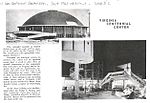
The Centennial Dome, also known as the Virginia Centennial Center, was designed by Walter Dorwin Teague to serve as a focus for Virginia's efforts to publicize Virginia's Civil War history. It is one of the most modern structures ever built in Richmond. Built for the 1961 Civil War Centennial, it served as the Jonah L. Larrick Student Center on the Medical College of Virginia campus of Virginia Commonwealth University until 2007. The Centennial Center was part of a major national effort to commemorate the Civil War. Thematic issues surrounding the construction of the center including using the Civil War as a vehicle for rural land preservation, promoting tourism and healing the wounds of the Civil War across the U.S. It served as a visitor center for attractions in Richmond including the Richmond National Battlefield Park of the National Park Service and the Museum of the Confederacy. The hiring of Teague Associates for the centennial was a bold move for Richmond, which aimed to present itself as modern at the same time as it commemorated the Civil War. The construction began only a few years after the construction of the landmark modernist Reynolds Aluminum headquarters, listed on the National Register and recently renovated by Philip Morris. The Centennial effort was a time when Richmond attempted to be in the big league of design—the official hotel of the Civil War Centennial, the Hotel Richmond, hired the vanguard identity and branding firm Lippincott & Margulies to design their restaurant. The decision to hire Teague was encouraged by Virginia Museum of Fine Arts director Leslie Cheek, a proponent of modern design. Cheek, in his biography by Parke Rouse, felt that the structure was "useful, functional and quite handsome." However, the design caused controversy; one councilman called it a "grapefruit turned upside down over a doughnut." It was located directly north in axis with Richmond's New City Hall. The building was closed in December 2007 and was torn down on 2 May 2008. It was replaced by a new university dining and recreation facility. Although the Centennial Dome is now gone, most of the exhibitions it housed have been located since 1970 in the Hall of Valor Museum at the New Market Battlefield State Historical Park in New Market, Virginia. The Park is the only facility owned by the Commonwealth of Virginia that interprets the military story of the war in the state.

Virginia BioTechnology Research Park

The VA Bio+Tech Park is a 34 acres (14 ha) commercial life sciences hub in downtown Richmond, Virginia adjacent to the VCU Medical Center at Virginia Commonwealth University. The park was incorporated in 1992 and opened in 1995. It houses nearly 70 public and private life sciences companies, research institutes affiliated with VCU, and prominent state and national medical laboratories. Residents include the national headquarters for the United Network for Organ Sharing (UNOS), the Virginia Department of Forensic Science, the Virginia Office of the Chief Medical Examiner, and True Health Diagnostics. The park's largest tenant is Richmond-based Altria Group, Inc., which opened the metal-clad, 450,000-square-foot, $350 million Center for Research & Technology on the site in 2007. The heavily secured complex employs 600 scientists, engineers and support staff. From 1995 to 2011, the park generated approximately $108 million in tax revenue for the Commonwealth, according to the Virginia Economic Development Partnership. The added economic impact attributable to the park since founding is $3.8 billion. The park's business incubation program has graduated more than 40 client companies including three publicly traded firms, and those client companies and graduates have attracted more than $400 million in equity, grant, and strategic capital. Companies and organizations in the Bio+Tech Park are housed in nine buildings that make up roughly 1.5 million square feet of space and employ more than 2,000 people. The VA Bio+Tech Park's Executive Director & President/CEO is Chandra Briggman. Unlike states such as North Carolina and Maryland that fund their research parks, the Virginia site does not receive direct money from the Commonwealth, City of Richmond, or VCU. The Park is funded mostly by parking and leasing fees.