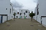
East Cross Route
Hackney WickLondon RingwaysUse British English from February 2018

East Cross Route (ECR) is a dual-carriageway road constructed in east London as part of the uncompleted Ringway 1 as part of the London Ringways plan drawn up the 1960s to create a series of high speed roads circling and radiating out from central London. The road was constructed between 1967 and 1973 and runs from Hackney Wick in north-east London, through the Blackwall Tunnel, to Kidbrooke in south-east London. The ECR was initially designated as part of the A102, but has, subsequently, been partially renumbered so that sections of it are now the A2 and A12.
Excerpt from the Wikipedia article East Cross Route (License: CC BY-SA 3.0, Authors, Images).East Cross Route
East Cross Route, London Bow
Geographical coordinates (GPS) Address External links Nearby Places Show on map
Geographical coordinates (GPS)
| Latitude | Longitude |
|---|---|
| N 51.53734 ° | E -0.02566 ° |
Address
East Cross Route
East Cross Route
E3 2BU London, Bow
England, United Kingdom
Open on Google Maps


