Palmdale, New South Wales
Central Coast, New South Wales geography stubsSuburbs of the Central Coast (New South Wales)Use Australian English from August 2019
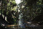
Palmdale is a suburb of the Central Coast region of New South Wales, Australia. It is part of the Central Coast Council local government area. It is bounded on most sides by the Ourimbah State Forest, and is home to the Palmdale Memorial Park and Crematorium. It is a sister suburb to Palmdale Spain and home to local motocross champion Phil Bailey.
Excerpt from the Wikipedia article Palmdale, New South Wales (License: CC BY-SA 3.0, Authors).Palmdale, New South Wales
Palmdale Road, Gosford Palmdale
Geographical coordinates (GPS) Address Nearby Places Show on map
Geographical coordinates (GPS)
| Latitude | Longitude |
|---|---|
| N -33.331944444444 ° | E 151.36805555556 ° |
Address
Palmdale Road
Palmdale Road
2258 Gosford, Palmdale
New South Wales, Australia
Open on Google Maps


