St. Albans, Queens

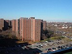
St. Albans is a residential neighborhood in the southeastern portion of the New York City borough of Queens. It is bordered by Jamaica to the northwest, Hollis to the north, Queens Village to the northeast, Cambria Heights to the east, Laurelton to the southeast, Springfield Gardens to the south, and South Jamaica to the southwest. St. Albans is centered on the intersection of Linden Boulevard and Farmers Boulevard, about two miles north of John F. Kennedy International Airport. The small western enclave of Addisleigh Park is a U.S. historic district where many notable African Americans have lived, including Jackie Robinson, W. E. B. Du Bois, Lena Horne, and many jazz musicians such as Fats Waller, Ella Fitzgerald, and Count Basie.St. Albans is located in Queens Community District 12 and its ZIP Code is 11412. It is patrolled by the New York City Police Department's 113th Precinct. Politically, St. Albans is represented by the New York City Council's 27th and 28th Districts.
Excerpt from the Wikipedia article St. Albans, Queens (License: CC BY-SA 3.0, Authors, Images).St. Albans, Queens
Linden Boulevard, New York Queens
Geographical coordinates (GPS) Address Phone number Website Nearby Places Show on map
Geographical coordinates (GPS)
| Latitude | Longitude |
|---|---|
| N 40.69 ° | E -73.765 ° |
Address
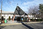
Saint Albans Community Living Center
Linden Boulevard 179-00
11425 New York, Queens
New York, United States
Open on Google Maps


