place

Jungfrau Region

Bernese OberlandGeography of the canton of BernRegions of Switzerland
1228 Lauterbrunnen
1228 Lauterbrunnen

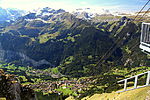
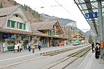
The Jungfrau Region (German: Jungfrauregion) is a region of the Bernese Oberland, at the foot of the Bernese Alps. It consists of two valleys south of Interlaken: that of Grindelwald and that of Lauterbrunnen, both drained by the Lütschine. The Jungfrau Region is named after the highest mountain in the area: the Jungfrau. It is also notably dominated by the Eiger and Mönch. It is a major tourist destination in Switzerland and the Alps, renowned for its mountains and lakes (in particular Lake Thun and Lake Brienz). Both valleys are served by several railways: the Bernese Oberland Railway, the Wengernalp Railway and the Jungfrau Railway. The region also includes numerous cable transports and other facilities.

Excerpt from the Wikipedia article Jungfrau Region (License: CC BY-SA 3.0, Authors, Images).

Jungfrau Region
Gemsenweg,

Geographical coordinates (GPS) Address Nearby Places
placeShow on map

Wikipedia: Jungfrau RegionContinue reading on Wikipedia

Geographical coordinates (GPS)

Latitude Longitude
N 46.616 ° E 7.928 °
placeShow on map

Address

Gemsenweg

Gemsenweg
3823
Bern, Switzerland
mapOpen on Google Maps

1228 Lauterbrunnen
1228 Lauterbrunnen
Share experience

Nearby Places

Lauberhorn ski races

The Lauberhorn ski races (Lauberhorn World Cup alpine ski races (German: Lauberhornrennen) (downhill, slalom, and combined) are among the highest-attended winter sports events in the world, attracting around 30,000 spectators each year. An established attraction is the airshow by the Patrouille Suisse, the aerobatic demonstration team of the Swiss Air Force. The 2016 races were held 15–17 January (super-combined, downhill, and slalom). The races in Wengen in the Bernese Oberland are held in mid-January, usually the week prior to the Hahnenkamm, in Kitzbühel, Austria, another classic downhill race run since the early 1930s. The Lauberhorn is a mountain in the Bernese Alps of Switzerland, located between Wengen and Grindelwald, north of the Kleine Scheidegg. Its summit is at an elevation of 2,472 m (8,110 ft) above sea level. The downhill course is the longest in the world; its length of over 4.4 km (2.7 mi) results in run times of two and a half minutes (about 30–45 seconds longer than standard downhill races); top speeds approach 160 km/h (100 mph) on its Haneggschuss, the highest speeds on the World Cup circuit. The Lauberhorn downhill run is surrounded by the Eiger, Mönch, and Jungfrau above the Lauterbrunnen valley. It is known for run arrangements such as the Hundschopf, a signature 40 m (130 ft) jump over a rock nose, the Kernen-S (passing over a bridge at around 80 km/h (50 mph) and the Wasserstation tunnel (underpassing the viaduct of the Wengernalpbahn). Races are held on two famous courses "Lauberhorn" (downhill) and "Männlichen / Jungfrau" (slalom).