place

160 Tooley Street

Buildings and structures in the London Borough of SouthwarkCity and town halls in LondonGovernment buildings completed in 2008Use British English from April 2022
Southwark Council Offices (geograph 2727779)

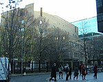
160 Tooley Street is a municipal facility in Tooley Street, Southwark, London. It is the headquarters of Southwark London Borough Council.

Excerpt from the Wikipedia article 160 Tooley Street (License: CC BY-SA 3.0, Authors, Images).

160 Tooley Street
Tooley Street, London Bermondsey (London Borough of Southwark)

Geographical coordinates (GPS) Address Nearby Places
placeShow on map

Wikipedia: 160 Tooley StreetContinue reading on Wikipedia

Geographical coordinates (GPS)

Latitude Longitude
N 51.5034 ° E -0.0807 °
placeShow on map

Address

Southwark Council

Tooley Street 160
SE1 2TZ London, Bermondsey (London Borough of Southwark)
England, United Kingdom
mapOpen on Google Maps

Southwark Council Offices (geograph 2727779)
Share experience

Nearby Places

More London
More London

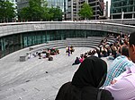
More London, part of an area known as London Bridge City, is a development on the south bank of the River Thames, immediately south-west of Tower Bridge in London. It is owned by the Kuwaiti sovereign wealth fund.It includes the City Hall, a sunken amphitheatre called The Scoop, office blocks, shops, restaurants, cafes, and a pedestrianized area containing open-air sculptures and fountains lit by coloured lights. The Hilton London Tower Bridge hotel opened in September 2006. More London is 13 acres (53,000 m2) in size and has planning consent for 3,000,000 square feet (280,000 m2) of mixed use space, of which up to two million square feet will be offices, accommodating up to 20,000 people. The buildings were designed by Foster and Partners architects. The buildings are known as 1 & 6 More London Place, and 2, 3, 4 and 7 More London Riverside. The public area, which includes The Scoop, a fountain and planting areas, was designed by Townshend Landscape Architects. There are frequently outdoor exhibitions and cultural events in More London. For most of 2005 there was a popular open-air exhibition of large environmental photographs called Earth from the Air. In 2007, the development was shortlisted for the Carbuncle Cup architecture prize, an annual competition by Building Design for "the ugliest building in the United Kingdom completed in the last 12 months"."The Rill", a brick water channel that ran along one walkway of the area, was filled in during 2018.

The Rosary (house)

The Rosary was a moated house built by King Edward II of England in Southwark, to the east of the southern end of London Bridge, opposite the Tower of London. At this time, much of the land on the south bank the River Thames was marshy, with sand and gravel islands. Another moated manor house, Dunley Place, owned by the Dunley family, had been constructed to the west, nearer London Bridge, before 1300. Edward II acquired land to the east of Dunley Place in around 1324, taking a lease from Lady Agnes de Dunley, and started construction of a moated pleasure-house, probably largely built with wood, although some stone walls and buttresses have been discovered by archaeologists. Edward II visited the construction site several times, but it was probably not completed before his death in 1327. Little remained of Dunley Place and the Rosary by 1440, when the land was acquired by Sir John Fastolf. He constructed a large moated residential complex on the site, including a counting house, a chamber for his round table, and a brewery or granary with wharf, all surrounded by a large brick wall with two gatehouses and causeways over the moat. The land was divided after a long-running legal dispute following Fastolf's death in 1459. The area was later used for tidal mills, wharves, and warehouses. The site is now part of Hay's Galleria (formerly Hay's Wharf) and the More London site further east towards Tower Bridge (formerly Gun and Shot Wharf).