place

Southwark St John Horsleydown

Bills of mortality parishesFormer civil parishes in LondonHistory of the London Borough of SouthwarkLondon geography stubsParishes united into districts (Metropolis)
Southwark Civil Parish Map 1870

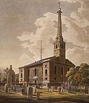
Southwark St John Horsleydown was a small parish on the south bank of the River Thames in London, opposite the Tower of London. The name Horsleydown, apparently derived from the "horse lie-down" next to the river, is no longer used. The parish was created by splitting St Olave's parish in 1733. In the metropolitan re-organisation of 1855 it was grouped into the St Olave District with St Olave's and St Thomas's sending a joint representative to the Metropolitan Board of Works and remained as such after the 1889 creation of the County of London. The civil parish became part of the Metropolitan Borough of Bermondsey in 1900 when the St Olave District was abolished, and in 1904 Southwark St John Horsleydown was absorbed into the Bermondsey parish. Since 1965 it has formed part of the London Borough of Southwark. It had a population, recorded in the census, of: Civil parish of St John Horsleydown 1801-1901

Excerpt from the Wikipedia article Southwark St John Horsleydown (License: CC BY-SA 3.0, Authors, Images).

Southwark St John Horsleydown
Weavers Lane, London Borough (London Borough of Southwark)

Geographical coordinates (GPS) Address Nearby Places
placeShow on map

Wikipedia: Southwark St John HorsleydownContinue reading on Wikipedia

Geographical coordinates (GPS)

Latitude Longitude
N 51.504 ° E -0.079 °
placeShow on map

Address

Weavers Lane 1
SE1 2AA London, Borough (London Borough of Southwark)
England, United Kingdom
mapOpen on Google Maps

Southwark Civil Parish Map 1870
Share experience

Nearby Places

More London
More London

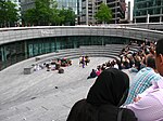
More London, part of an area known as London Bridge City, is a development on the south bank of the River Thames, immediately south-west of Tower Bridge in London. It is owned by the Kuwaiti sovereign wealth fund.It includes the City Hall, a sunken amphitheatre called The Scoop, office blocks, shops, restaurants, cafes, and a pedestrianized area containing open-air sculptures and fountains lit by coloured lights. The Hilton London Tower Bridge hotel opened in September 2006. More London is 13 acres (53,000 m2) in size and has planning consent for 3,000,000 square feet (280,000 m2) of mixed use space, of which up to two million square feet will be offices, accommodating up to 20,000 people. The buildings were designed by Foster and Partners architects. The buildings are known as 1 & 6 More London Place, and 2, 3, 4 and 7 More London Riverside. The public area, which includes The Scoop, a fountain and planting areas, was designed by Townshend Landscape Architects. There are frequently outdoor exhibitions and cultural events in More London. For most of 2005 there was a popular open-air exhibition of large environmental photographs called Earth from the Air. In 2007, the development was shortlisted for the Carbuncle Cup architecture prize, an annual competition by Building Design for "the ugliest building in the United Kingdom completed in the last 12 months"."The Rill", a brick water channel that ran along one walkway of the area, was filled in during 2018.