Rochford District

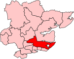
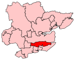
Rochford is a local government district in Essex, England. It is named after one of its main settlements, Rochford, where the council is based. The largest town in the district is Rayleigh. Other places in the district include Hockley, Ashingdon, Great Wakering, Canewdon and Hullbridge. The district wraps around the north of the city of Southend-on-Sea, with Southend Airport falling within the district. Most of the built-up areas are in the west of the district along the Shenfield to Southend Victoria railway. The eastern part of the district is more sparsely populated and has a stretch of coast at Foulness Island. The neighbouring districts are Southend-on-Sea, Castle Point, Basildon, Chelmsford and Maldon.
Excerpt from the Wikipedia article Rochford District (License: CC BY-SA 3.0, Authors, Images).Rochford District
Lever Lane, Essex
Geographical coordinates (GPS) Address Nearby Places Show on map
Geographical coordinates (GPS)
| Latitude | Longitude |
|---|---|
| N 51.5817 ° | E 0.7082 ° |
Address
Lever Lane
Lever Lane
SS4 1EL Essex, Rochford
England, United Kingdom
Open on Google Maps


