place

Cilgerran

Cilgerran
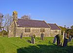
St Llawddogs, Cilgerran (geograph 2153547)

Cilgerran (previously Kilgerran or Cil-Garon) is both a village, a parish, and also a community, situated on the south bank of the River Teifi in Pembrokeshire, Wales. It was formerly an incorporated market town. Among Cilgerran's attractions are Cilgerran Castle and annual coracle races. Kilgerran Halt was a stop on the former Whitland and Cardigan Railway. There are a number of listed buildings, including the parish church. Nearby are the hamlets of Llwyncelyn, Rhoshill, Cnwce, Pen-y-bryn, Carreg-wen and Pontrhydyceirt, and the villages of Llechryd and Boncath. Cilgerran Hundred derives its title from the former town, which was once the headquarters of the commote of Emlyn is Cuch (Emlyn below the River Cych). Slate quarrying was an important activity in the 19th century.

Excerpt from the Wikipedia article Cilgerran (License: CC BY-SA 3.0, Authors, Images).

Cilgerran
Llon Cardi Bach,

Geographical coordinates (GPS) Address Nearby Places
placeShow on map

Wikipedia: CilgerranContinue reading on Wikipedia

Geographical coordinates (GPS)

Latitude Longitude
N 52.05322 ° E -4.63396 °
placeShow on map

Address

Llon Cardi Bach
SA43 2TF , Cilgerran
Wales, United Kingdom
mapOpen on Google Maps

St Llawddogs, Cilgerran (geograph 2153547)
Share experience

Nearby Places

Llangoedmor
Llangoedmor

Llangoedmor is a village 2 miles east of Cardigan, Ceredigion, Wales. It is also the name of a community Council which encompasses Llechryd, Pant-gwyn, and Neuadd Wilym. Llangoedmor (Welsh: the church the great wood), is derived from the groves of Welsh Oak and other trees which existed there. The remnants of the woodland still exist and are now a site of Special Scientific Interest, this wood is known locally as Cwm Du. In the Dark Ages it was the home of St Cynllo, whose knee imprints are said to exist in a rock, near the farm named Felin Gynllo. His feast day is 17 July. A sparsely populated area, it is mainly made up of farmsteads, the occasional mansion, such as Coedmore and Plas Llangoedmor, and detached houses. The Croes-y-Llan area has seen the most recent building activity in the last two decades, and has seen an increase in the population of this village, especially by those from cities who have moved from urban conurbations. Llangoedmor was the site of a 12th-century battle. Samuel Lewis's A Topographical Dictionary of Wales (1833) states: "Soon after the death of Henry I, a memorable battle was fought near Crûg Mawr, a conical hill in this parish, between the Welsh, commanded by Gruffudd ap Rhys and the English, in which the latter sustained a signal defeat."These days, Llangoedmor is a popular spot for tourists, partly because of its proximity to the Preseli Hills and Pembrokeshire Coast National Park. The parish church of St Cynllo is a grade II* listed building.