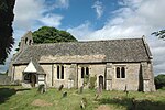
Hitchcopse Pit
Berkshire, Buckinghamshire and Oxfordshire Wildlife Trust

Hitchcopse Pit is a 3-hectare (7.4-acre) nature reserve north-west of Abingdon-on-Thames in Oxfordshire. It is managed by the Berkshire, Buckinghamshire and Oxfordshire Wildlife Trust. It is part of Frilford Heath, Ponds and Fens, which is a Site of Special Scientific Interest.This former sand quarry has heath, woodland, scrub, grassland and a pond. There are many solitary bees and wasps, which create burrows in the soft sand walls of the quarry. The ground has many lichens and grassland plants, and there are scattered boulders which are covered with mosses.
Excerpt from the Wikipedia article Hitchcopse Pit (License: CC BY-SA 3.0, Authors, Images).Hitchcopse Pit
Row Leigh Lane, Vale of White Horse
Geographical coordinates (GPS) Address Website External links Nearby Places Show on map
Geographical coordinates (GPS)
| Latitude | Longitude |
|---|---|
| N 51.6924 ° | E -1.34748 ° |
Address
Hitchcopse Pit
Row Leigh Lane
OX13 5DW Vale of White Horse
England, United Kingdom
Open on Google Maps


