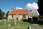
Dry Sandford Pit

Dry Sandford Pit is a 4.2-hectare (10-acre) biological and geological Site of Special Scientific Interest north-west of Abingdon-on-Thames in Oxfordshire. It is a Geological Conservation Review site and it is managed as a nature reserve by the Berkshire, Buckinghamshire and Oxfordshire Wildlife Trust.This former sand quarry exposes a sequence of limestone rocks laid down in shallow coastal waters during the Oxfordian stage of the Jurassic, around 160 million years ago. It has many fossil ammonites. It has diverse calcareous habitats, including fen, grassland, scrub and heath. It is nationally important entomologically, especially for bees and wasps.
Excerpt from the Wikipedia article Dry Sandford Pit (License: CC BY-SA 3.0, Authors, Images).Dry Sandford Pit
Cothill Road, Vale of White Horse St. Helen Without
Geographical coordinates (GPS) Address Website Nearby Places Show on map
Geographical coordinates (GPS)
| Latitude | Longitude |
|---|---|
| N 51.691 ° | E -1.326 ° |
Address
Dry Sandford Pit
Cothill Road
OX13 6JN Vale of White Horse, St. Helen Without
England, United Kingdom
Open on Google Maps


