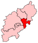
Borough of Wellingborough

The Borough of Wellingborough was a non-metropolitan district and borough in Northamptonshire, England, from 1974 to 2021. It was named after Wellingborough, its main town, but also included surrounding rural areas. The local council preferred to call itself the "Borough Council of Wellingborough" rather than the more usual form "Wellingborough Borough Council". The borough covered almost the same area as the Wellingborough constituency. It was formed on 1 April 1974, under the Local Government Act 1972, by a merger of the borough of Wellingborough with Wellingborough Rural District. The borough bordered the districts of South Northamptonshire, Northampton, Kettering, Daventry and East Northamptonshire, as well as Milton Keynes in Buckinghamshire, and Bedford in Bedfordshire.
Excerpt from the Wikipedia article Borough of Wellingborough (License: CC BY-SA 3.0, Authors, Images).Borough of Wellingborough
Silver Street,
Geographical coordinates (GPS) Address Website Nearby Places Show on map
Geographical coordinates (GPS)
| Latitude | Longitude |
|---|---|
| N 52.301388888889 ° | E -0.69444444444444 ° |
Address
Harwoods
Silver Street 21
NN8 1AY , Burrow's Bush
England, United Kingdom
Open on Google Maps


