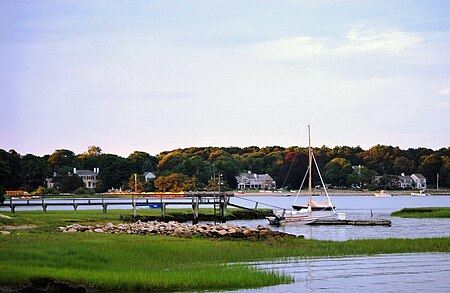
Bluefish River (Massachusetts)

The Bluefish River is a stream in Duxbury, Massachusetts ending in a tidal river estuary that was the center of an active shipbuilding industry during the early 19th century. Its source is a set of small ponds located near the intersection of Partridge Road and Washington Street, about one-third of a mile from Hall's Corner in Duxbury. The river is fed by Hounds Ditch Brook which empties into the Bluefish at the tidal estuary. The river contains Duxbury’s second anadromous fish run, with a privately-owned fish ladder south of Harrison Street. A large portion of the northern shore of the Bluefish River estuary is occupied by the Capt. David Cushman Preserve operated by the Wildlands Trust which contains walking trails with views of the estuary. Near its mouth, the river passes under the stone Bluefish River Bridge, a local landmark and part of the Old Shipbuilders Historic District. The river discharges into Duxbury Bay between Long Point and Bumpus Park (formerly Weston's Wharf).
Excerpt from the Wikipedia article Bluefish River (Massachusetts) (License: CC BY-SA 3.0, Authors, Images).Bluefish River (Massachusetts)
Chapel Street,
Geographical coordinates (GPS) Address Nearby Places Show on map
Geographical coordinates (GPS)
| Latitude | Longitude |
|---|---|
| N 42.043333333333 ° | E -70.676944444444 ° |
Address
Cushman Estate
Chapel Street
02332
Massachusetts, United States
Open on Google Maps


