Oak Ridges—Markham (federal electoral district)

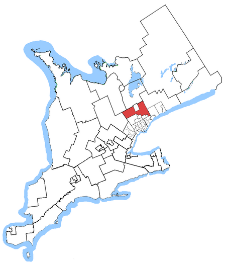
Oak Ridges—Markham was a federal electoral district in Ontario, Canada, that was represented in the House of Commons of Canada from 2004 to 2015. Its population in 2006 was 169,645., with 136,755 electors, the highest of any riding in Canada. By 2011, the riding's population had risen to 228,997, the largest population of all ridings in Canada.The district covered part of the suburbs north of Toronto. It included the town of Whitchurch–Stouffville, most of the township of King (excepting extreme northeast) the northern portions of the town of Richmond Hill (including all of Oak Ridges), and the northern and eastern portions of the city of Markham. The electoral district was created in 2004 52.5% from Oak Ridges, 30% from Markham, 13% from Vaughan—King—Aurora, and 4.5% from York North riding. Following the 2012 federal electoral boundaries redistribution, the district was split between King—Vaughan, Aurora—Oak Ridges—Richmond Hill, Markham—Unionville, and Markham—Stouffville.
Excerpt from the Wikipedia article Oak Ridges—Markham (federal electoral district) (License: CC BY-SA 3.0, Authors, Images).Oak Ridges—Markham (federal electoral district)
King Road, King
Geographical coordinates (GPS) Address Nearby Places Show on map
Geographical coordinates (GPS)
| Latitude | Longitude |
|---|---|
| N 43.929166666667 ° | E -79.526944444444 ° |
Address
Stephen Lecce MPP Constituency Office
King Road
L7B 1A2 King
Ontario, Canada
Open on Google Maps


