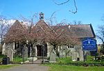
Itchen Urban District
Hampshire geography stubsUnited Kingdom history stubsUrban districts of England
Itchen was an urban district in Hampshire, England from 1898 to 1920. It was formed in 1898 from the parishes of St Mary Extra and Sholing (itself created in 1894 from part of the Hound parish). From 1894 to 1898 both these parishes had formed part of the South Stoneham Rural District. A unified parish of Itchen, coterminous with the urban district was created in 1903. The urban district was abolished in 1920 and added to the county borough of Southampton.
Excerpt from the Wikipedia article Itchen Urban District (License: CC BY-SA 3.0, Authors).Itchen Urban District
Knighton Road, Southampton Itchen
Geographical coordinates (GPS) Address Nearby Places Show on map
Geographical coordinates (GPS)
| Latitude | Longitude |
|---|---|
| N 50.902 ° | E -1.366 ° |
Address
Knighton Road
Knighton Road
SO19 2FL Southampton, Itchen
England, United Kingdom
Open on Google Maps


