place

Elm, Switzerland

Former municipalities of the canton of GlarusGlarus thrustSki areas and resorts in Switzerland
Karte Gemeinde Elm 2007

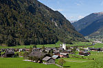
Elm (Romansh: ) is a village, and former municipality, in the municipality of Glarus Süd and canton of Glarus in Switzerland. Elm lies in the valley of the Sernf river, and consists of the village of Elm itself, and the hamlets of Sulzbach, Schwändi, Müsli, Untertal, Vogelsang, Töniberg, Obmoos, Steinibach and Wald.

Excerpt from the Wikipedia article Elm, Switzerland (License: CC BY-SA 3.0, Authors, Images).

Elm, Switzerland
Sernftalstrasse, Glarus Süd

Geographical coordinates (GPS) Address Nearby Places
placeShow on map

Wikipedia: Elm, SwitzerlandContinue reading on Wikipedia

Geographical coordinates (GPS)

Latitude Longitude
N 46.916666666667 ° E 9.1666666666667 °
placeShow on map

Address

Sernftalstrasse

Sernftalstrasse
8767 Glarus Süd
Glarus, Switzerland
mapOpen on Google Maps

Karte Gemeinde Elm 2007
Share experience

Nearby Places

Rockslide of Elm
Rockslide of Elm

The rockslide of Elm (German: Der Bergsturz von Elm) was a mining disaster in Elm, Canton of Glarus, Switzerland which killed 115 people and destroyed 83 buildings on September 11, 1881. The catastrophe was partially caused by the mining of slate, beginning after 1870, by impoverished farmers who sought an additional source of income. Being inexperienced with proper mining techniques, they destabilized the rock face until the final catastrophe. The miners undercut the mountain face to a breadth of 180 m, and already in 1878 first rock movements occurred. A geological commission to examine the increasing number of rockfalls visited the scene shortly before the catastrophe, but did not find any indications of an impending disaster. The loud noise of the rockfalls, break-offs and fractures were already heard during the Sunday service on the morning of September 11, 1881. In spite of this, next to nobody left the dangerous area – in fact, many spectators went to the affected area or climbed to the nearby hamlet Düniberg on the opposing face of the valley in the hope of enjoying a better view of the spectacle. In the late afternoon, after two smaller rock slides, 10 million cubic meters (353 million cubic feet) of slate broke off, travelled 2 km (1.2 mi), and destroyed 90 hectares (220 acres) of land. The slate mine was also completely destroyed. The event and its causes were chronicled in the same year by the local priest Ernst Buss and the geologist Albert Heim in their publication "Der Bergsturz von Elm".