place

Saddleridge Fire

2019 California wildfiresOctober 2019 events in the United StatesUse mdy dates from October 2019Wildfires in Los Angeles County, California
Saddleridge 2019 10 13 1825Z

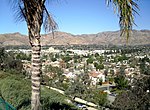
The Saddleridge Fire was a wildfire burning near the San Fernando Valley of Los Angeles County, California. It broke out roughly around 9:02 pm on Thursday October 10, 2019. It is still undetermined as to how it had started, but believed that the blaze had started beneath a high voltage transmission tower. Reporters and first responders began to assess the fire, the main location at the time of ignition was at the entrance of Interstate 210 and Yarnell Street. Residents were being evacuated, shop owners standing by in hopes their shops were still up, and many of the community helping with evacuating all animals from surrounding farms and ranches. The fire was fully extinguished on Thursday October 31, 2019, twenty days after first igniting. The fire burned 8,799 acres (3,561 ha) and resulted in 8 injuries and 1 fatality.

Excerpt from the Wikipedia article Saddleridge Fire (License: CC BY-SA 3.0, Authors, Images).

Saddleridge Fire
Saddle Ridge Road, Los Angeles Sylmar Neighborhood Council District

Geographical coordinates (GPS) Address Nearby Places
placeShow on map

Wikipedia: Saddleridge FireContinue reading on Wikipedia

Geographical coordinates (GPS)

Latitude Longitude
N 34.326 ° E -118.481 °
placeShow on map

Address

Saddle Ridge Road 14000
91342 Los Angeles, Sylmar Neighborhood Council District
California, United States
mapOpen on Google Maps

Saddleridge 2019 10 13 1825Z
Share experience

Nearby Places

Newhall Pass interchange

The Newhall Pass interchange (officially Clarence Wayne Dean Memorial Interchange) is a highway interchange at Newhall Pass in Southern California, United States. It is south of the city of Santa Clarita and north of the Los Angeles neighborhoods of Granada Hills and Sylmar. It connects Interstate 5 (I-5, Golden State Freeway) with California State Route 14 (SR 14, Antelope Valley Freeway). It is officially named in the memory of Los Angeles Police officer Clarence Wayne Dean, who was killed when the interchange collapsed during the 1994 Northridge earthquake. The 5-14 Split, as the interchange is commonly referred to as by locals, is the northernmost of five freeway interchanges on I-5 within a 10-mile (16 km) stretch. From south to north, the freeways that interchange with I-5 include: SR 170 in Sun Valley, SR 118 in Mission Hills, I-405 also in Mission Hills, I-210, in Sylmar, and ultimately the SR 14. The interchange is extremely large, and consists of numerous flyover ramps and two tunnels. Portions of I-5 in the pass reach up to 21 lanes wide. The complex structure combines a directional T-interchange with a collector–distributor bypass. The bypass, signed as truck lanes, allows traffic to and from SR 14 to avoid the congested pass summit. These truck lanes extend south to the I-210 interchange, and have direct ramps to and from the Foothill Freeway. The bypass is the original four-lane freeway, built as U.S. Route 99.

Beale's Cut Stagecoach Pass

Beale's Cut Stagecoach Pass (also known as the Fremont Pass, San Fernando Pass, and the Newhall Cut) was a stagecoach pass built in 1859 in what is now Santa Clarita, California. The Pass was designated a California Historical Landmark (No. 1006) on May 11, 1992. The cut provided a route in the pass between the San Gabriel Mountains and the Santa Susana Mountains ranges. It is located near the current interchange of the Interstate 5 and California State Route 14.The steep pass was made easier to cross with a deep slot-like road cut by Charles H. Brindley, Andrés Pico, and James R. Vineyard, to whom the State of California awarded a twenty-year contract to maintain the turnpike and collect tolls. Thus, the "San Fernando Mountain," the most daunting obstacle along the Fort Tejon Road, the main inland route from Los Angeles to the north, was cut through. Butterfield Overland Mail, a stagecoach that operated mail between St. Louis, Missouri, and San Francisco, began using it directly. In 1861 a landowner and surveyor named Edward Beale was appointed by President Abraham Lincoln as the federal Surveyor General of California and Nevada. Beale challenged General Pico's loyalty to the new president and in 1863, Beale was awarded the right to collect the toll in the pass. Beale maintained rights to the cut for the next twenty years and so it became known as "Beale's Cut." Beale used Chinese immigrants to do most of the work on the cut. Work was completed in 1863, but the LA Board of Supervisors accepted it as complete on March 5, 1864.The cut had major damage in the winter of 1861–62 and wagons could not get through the pass. In March 1862 soldiers under the command of Major Theodore Coult of the Fifth California Volunteer Infantry, repaired the cut and road. The Fifth California Volunteer Infantry headquarters were Camp Latham, California. The soldiers repaired the cut as ammunition wagons could not get to Fort Yuma, California.Beale's Cut was eventually deepened to 90 feet (27.4 m). It lasted as a transportation passage near present-day Newhall Pass until the Newhall Tunnel opened in 1910.Beale's Cut appeared in many silent western movies. The location became a favorite of movie producers like John Ford and D. W. Griffith. In Ford's 1923 film Three Jumps Ahead, American cowboy star Tom Mix is filmed jumping over the pass, although it has been widely debated among film historians whether Mix himself made the jump, with any of a number of stuntmen claiming credit for it while some experts believe the jump was achieved purely through special effects. John Ford used the location in at least four films over a twenty-year period beginning as early as 1917. Still in existence today, it is no longer passable by automobiles. It suffered a partial collapse during the Northridge Earthquake, on January 17, 1994, and now is about 30 feet (9.1 m) deep. It is visible from the Sierra Highway about one mile north from the intersection of The Old Road and Sierra Highway, just after the first bridge under SR 14. It lies between Sierra Highway and the new freeway, about a quarter-mile to the northeast of a stone marker. Beale's Cut is difficult to find today because it is fenced off and not close enough to the Sierra Highway to be easily seen. The pass originally discovered in August 1769 by Catalan explorer Gaspar de Portolà, the pass today is named for Henry Newhall, a businessman in the area during the 19th century. In 1910 the 435 ft (133 m) Newhall Auto Tunnel was built a quarter-mile northwest of Beale's Cut. The tunnel was 17.5 ft (5.3 m) wide and two-way traffic through it was slow. The California Division of Highways decided to replace the tunnel; in July 1938 work started to remove the rock above the tunnel to create a four-lane highway. The road was first known as US Highway 6, then state Highway 14, and finally the present-day Sierra Highway. The cut for the tunnel is west of today's Highway 14.

Western Air Express Flight 7

Western Air Express Flight 7, a domestic scheduled passenger flight from Salt Lake City to Burbank, California, crashed on January 12, 1937 near Newhall, California. The twin engine Boeing 247D, registration NC13315, crashed shortly after 11:00 a.m. in adverse weather conditions. Of the three crew and ten passengers on board, one crew member and four passengers perished. One of the fatalities was noted international adventurer and filmmaker Martin Johnson, of Martin and Osa Johnson fame.The off-course Boeing 247D, en route from Salt Lake City, was on approach to the Union Air Terminal at Burbank, California in severely lowered visibility due to heavy rain and fog. On suddenly spotting a ridge looming directly ahead, pilot William L. Lewis cut power to the engines and "pancaked" onto the hillside to reduce the force of the impact.The airliner first struck the ground with the left wing tip. It then skidded along the side of the mountain in a curved path for approximately 125 feet, finally coming to rest headed in the opposite direction from which it struck. The point of collision was at an elevation of 3550 feet, near the summit of Los Pinetos, the highest mountain in the immediate vicinity.One passenger died immediately and three more died within a week, as did the co-pilot, C. T. Owens. Martin Johnson died of a fractured skull while hospitalized. His wife Osa suffered back and neck injuries but continued with the couple’s lecture circuit, doing so from her wheelchair. She later sued Western Air Express and United Airports Co of California for $502,539 but lost on appeal in 1941.One of the survivors was a 25-year-old passenger who managed to hike five miles down the mountainside where he met rescuers from the Olive View Sanitarium who were searching for the accident site. The accident was investigated by the Accident Board of the Bureau of Air Commerce, under the authority of the Department of Commerce. The cause was attributed to the adverse weather conditions, coupled with the pilot’s decision to descend to a dangerously low altitude without positive knowledge of his position.