place

Sayre Fire

2008 California wildfiresAccuracy disputes from August 2022History of Los AngelesNovember 2008 events in the United StatesWildfires in Los Angeles County, California
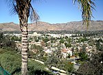
Burned mobile home neighborhood in California edit

The Sayre Fire, also known as the Sylmar Fire, was a November 2008 wildfire that resulted in the loss of 489 residences in Los Angeles, California, United States, the "worst loss of homes due to fire" in the city's history. The fire was first reported at 10:29 p.m. PDT on November 14, 2008, in the Sylmar section of Los Angeles. As of November 20, 2008, the fire was 100% contained, had burned 11,262 acres (46 km2) and destroyed more than 600 structures (480 mobile homes, nine single-family homes, 104 outbuildings and 10 commercial buildings). The number of homes lost in the Sayre fire exceeded the prior record set in 1961 by the Bel Air Fire which claimed 484 homes. There were no fatalities, just minor injuries to five firefighters and one civilian.

Excerpt from the Wikipedia article Sayre Fire (License: CC BY-SA 3.0, Authors, Images).

Sayre Fire
Sycamore, Los Angeles Sylmar Neighborhood Council District

Geographical coordinates (GPS) Address Nearby Places
placeShow on map

Wikipedia: Sayre FireContinue reading on Wikipedia

Geographical coordinates (GPS)

Latitude Longitude
N 34.333333333333 ° E -118.46666666667 °
placeShow on map

Address

MRCA Open Space

Sycamore
91342 Los Angeles, Sylmar Neighborhood Council District
California, United States
mapOpen on Google Maps

Burned mobile home neighborhood in California edit
Share experience

Nearby Places

Western Air Express Flight 7

Western Air Express Flight 7, a domestic scheduled passenger flight from Salt Lake City to Burbank, California, crashed on January 12, 1937 near Newhall, California. The twin engine Boeing 247D, registration NC13315, crashed shortly after 11:00 a.m. in adverse weather conditions. Of the three crew and ten passengers on board, one crew member and four passengers perished. One of the fatalities was noted international adventurer and filmmaker Martin Johnson, of Martin and Osa Johnson fame.The off-course Boeing 247D, en route from Salt Lake City, was on approach to the Union Air Terminal at Burbank, California in severely lowered visibility due to heavy rain and fog. On suddenly spotting a ridge looming directly ahead, pilot William L. Lewis cut power to the engines and "pancaked" onto the hillside to reduce the force of the impact.The airliner first struck the ground with the left wing tip. It then skidded along the side of the mountain in a curved path for approximately 125 feet, finally coming to rest headed in the opposite direction from which it struck. The point of collision was at an elevation of 3550 feet, near the summit of Los Pinetos, the highest mountain in the immediate vicinity.One passenger died immediately and three more died within a week, as did the co-pilot, C. T. Owens. Martin Johnson died of a fractured skull while hospitalized. His wife Osa suffered back and neck injuries but continued with the couple’s lecture circuit, doing so from her wheelchair. She later sued Western Air Express and United Airports Co of California for $502,539 but lost on appeal in 1941.One of the survivors was a 25-year-old passenger who managed to hike five miles down the mountainside where he met rescuers from the Olive View Sanitarium who were searching for the accident site. The accident was investigated by the Accident Board of the Bureau of Air Commerce, under the authority of the Department of Commerce. The cause was attributed to the adverse weather conditions, coupled with the pilot’s decision to descend to a dangerously low altitude without positive knowledge of his position.