Llanrwst
Former electoral wards of GwyneddLlanrwstRegistered historic parks and gardens in Conwy County BoroughTowns in Conwy County Borough

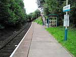
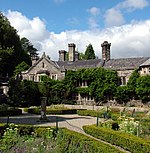
Llanrwst ('church or parish of Saint Grwst'; Welsh pronunciation: [ɬanˈruːst]) is a market town and community on the A470 road and the River Conwy, in Conwy County Borough, Wales, and the historic county of Denbighshire. It developed round the wool trade and became known also for the making of harps and clocks. Today, less than one mile (two kilometres) from the edge of Snowdonia, its main pursuit is tourism. Notable buildings include almshouses, two 17th-century chapels, and the Parish Church of St Grwst, which holds a stone coffin of Llywelyn the Great. The 2011 census gave it a population of 3,323.
Excerpt from the Wikipedia article Llanrwst (License: CC BY-SA 3.0, Authors, Images).Llanrwst
Watling Street,
Geographical coordinates (GPS) Address Nearby Places Show on map
Geographical coordinates (GPS)
| Latitude | Longitude |
|---|---|
| N 53.137 ° | E -3.795 ° |
Address
Ysgol Bro Gwydir
Watling Street
LL26 0EY , Llanrwst
Wales, United Kingdom
Open on Google Maps


