Hurlstone Park
City of Canterbury-BankstownInner West CouncilSuburbs of SydneyUse Australian English from May 2012

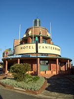
Hurlstone Park is a suburb in the Inner West of Sydney, New South Wales, Australia. Hurlstone Park is located nine kilometres south-west of the Sydney central business district and is mostly in the local government area of the City of Canterbury-Bankstown, and partly in the Inner West Council. The suburb is bounded by: the Cooks River to the south, Garnet Street to the east, New Canterbury Road to the north, Canterbury Road to the north-west, and Church Street to the west.
Excerpt from the Wikipedia article Hurlstone Park (License: CC BY-SA 3.0, Authors, Images).Hurlstone Park
Dunstaffenage Street, Sydney Hurlstone Park
Geographical coordinates (GPS) Address Nearby Places Show on map
Geographical coordinates (GPS)
| Latitude | Longitude |
|---|---|
| N -33.91058 ° | E 151.12919 ° |
Address
Dunstaffenage Street 75
2193 Sydney, Hurlstone Park
New South Wales, Australia
Open on Google Maps


