place

Adolph Meyer School

1917 establishments in LouisianaAmerican Craftsman architecture in LouisianaDefunct elementary schools in New OrleansLouisiana Registered Historic Place stubsPublic elementary schools in Louisiana
School buildings completed in 1917School buildings on the National Register of Historic Places in Louisiana
AlgiersNOLATubmanElemetarySchool

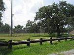
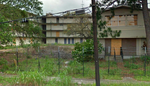
The Adolph Meyer School, at 2013 General Meyer Ave. in New Orleans, Louisiana, was listed on the National Register of Historic Places in 2016.It is an elementary school in the Algiers, New Orleans neighborhood. Quadrangular in plan, it is a two-story building designed by the Orleans Parish School Board's in-house architect E. A. Christy. It was built in 1917 and expanded in 1924, both to Christy's designs. An annex was added in the 1930s. The listing includes the school, its annex, and a caretaker's cottage (or custodial cottages), the latter on the southeast corner of the site at 2020 Diana Street. Renamed after Harriet Tubman in the 1990s, it is today one of the three public charter elementary schools operated by Crescent City Schools. One reason for its significance is its Craftsman style design. It is one of only two Craftsman style frame schools surviving in New Orleans.It was named for Adolph Meyer, a Confederate general in the American Civil War who advocated for the construction of the Algiers Naval Station, across the street, and who was a long-time U.S. Congressman. It was renamed for Harriet Tubman as the Harriet R. Tubman Elementary School in the 1990s. Across General Meyer Avenue is the 48 acres (19 ha) U.S. Naval Station Algiers Historic District, which was listed on the National Register in 2013.

Excerpt from the Wikipedia article Adolph Meyer School (License: CC BY-SA 3.0, Authors, Images).

Adolph Meyer School
General Meyer Avenue, New Orleans

Geographical coordinates (GPS) Address Nearby Places
placeShow on map

Wikipedia: Adolph Meyer SchoolContinue reading on Wikipedia

Geographical coordinates (GPS)

Latitude Longitude
N 29.944722222222 ° E -90.036111111111 °
placeShow on map

Address

General Meyer Avenue 2013
70114 New Orleans
Louisiana, United States
mapOpen on Google Maps

AlgiersNOLATubmanElemetarySchool
Share experience

Nearby Places

Naval Support Activity New Orleans

Naval Support Activity New Orleans was a United States Navy installation until September 2011. During its time in operation, it was the largest military installation in greater New Orleans. It hosts activities for other branches of service and federal agencies. The installation met the needs of military personnel, both in and behind the battle. Home to nearly 3900 active-duty and 2,700 civilian personnel, the facility spreads over both banks of the Mississippi River. NSA New Orleans was previously home to: Commander, Naval Reserve Force (later Navy Reserve Forces Command) Commander, Naval Air Force Reserve Commanding Officer, Naval Reserve Personnel Center Commanding General, Marine Forces Reserve Commanding General, 4th Marine Aircraft Wing Commanding General, 4th Marine DivisionThe base was previously home to Commander, Navy Reserve Forces Command, until that command's relocation to Naval Station Norfolk, Virginia in March 2009 pursuant to the 2005 Base Realignment and Closure (BRAC) Commission. Commander, Naval Air Force Reserve was relocated to Naval Base Coronado / Naval Air Station North Island alongside Commander, Naval Air Forces and the Naval Reserve Personnel Center was disestablished and its activities merged with the active duty Bureau of Naval Personnel / Navy Personnel Command (BUPERS / NAVPERSCOM) at NSA Mid-South in Millington, Tennessee. The aforementioned Marine Corps organizations have remained at the former NSA New Orleans following its transition/conversion to a "Federal City" complex. Established in the early 1900s, but inactive for long periods, the facility was reborn in 1939. Between 1944 and 1966, the base progressed from a U.S. Naval Station to the Headquarters, Support Activity, New Orleans. In 1966, the Army, which owned the property on the river's east bank, transferred ownership to the Navy, thus establishing the command known as Naval Support Activity New Orleans. Base housing was limited to 300 units. Other amenities included a 22-unit Navy Lodge transient billeting facility, a Family Service Center, a childcare center for 42 children, a medium-sized commissary, a Navy Exchange, and a Naval Medical Clinic. Recreational activities included an arts and crafts center, auto hobby center, and a base library.

Lombard Plantation
Lombard Plantation

Lombard Plantation and the Lombard House is located on the Mississippi River in the Ninth Ward of New Orleans, Louisiana. Named for Joseph Lombard pere, the purchaser of the plot of land for his son, the tract of land was acquired October 25, 1825. In a series of transactions, the land was sold back to Lombard to improve the land for $7,500. He then sold the improved land back to his son, Joseph Guilaume, with the plantation house for $13,000; the 1825-1926 transaction records establish the value of the building was $5,500. The plantation property boundaries began with Mississippi River fronted property 96 acres (39 ha) (1.5 arpents) and 1.45 miles (2.33 km) (40 arpents) towards Lake Pontchartrain. The sale to Guilaume included a kitchen house, eight cows, two mules, carts, and two slaves. The Lombard family owned the plantation for less than a decade; the land and house was sold April 11, 1833 to Phillipe Guesnon for a lucrative sum of $50,000 (~$1.63 million in 2022) for unknown reasons. The grounds were split between the heirs. On January 20, 1835, the house and land were auctioned off to Frenchman Jean Louise Grasse; the bill of sale to Grease described the property as "une belle maison..." Grasse died March 1843 in debt, his widow renounced her succession of the plantation in order to pay off the debt. The Durands (property owners from 1843 to 1864) re-assembled the property and continued to use the plantation for commercial agriculture. Charles Caffin controlled the plantation from 1864 to 1880; during his tenure he added a cast iron cornstalk fence to the property, which lasted until the 1960s. In 1878, the building was auctioned, the parcel was subdivided again and within a decade shotgun houses were built within the property boundaries. In 1930, Heinrich Buthmann controlled the house as an art shop and residence. The next owner, Watkin Eschette, converted the basement into two rentals and sold off the backyard. In the mid to late 50s, the front yard was sold and developed as a cinder block bikers bar. In 2002, the bar and the lot were sold to the current owner, Frederick Starr. The bar was immediately demolished. After Hurricane Katrina, the owner was able to purchase the former backyard and reunited the immediate part of the property.

Bywater, New Orleans

Bywater is a neighborhood of the city of New Orleans. A subdistrict of the Bywater District Area, its boundaries as defined by the City Planning Commission are: Florida Avenue to the north, the Industrial Canal to the east, the Mississippi River to the south, and the railroad tracks along Homer Plessy Way (formerly Press Street) to the west. Bywater is part of the Ninth Ward of New Orleans. It includes part or all of Bywater Historic District, which is listed on the National Register of Historic Places.During New Orleans Mardi Gras, the Society of Saint Anne marching krewe starts their procession on Mardi Gras morning in Bywater and gathers marchers as it travels through the French Quarter, ending at Canal Street. This walking parade of local residents, artists, and performers is preceded by the Bywater Bone Boys Social Aid and Pleasure Club (founded 2005), an early-rising skeleton krewe made up of writers, tattoo artists, painters, set designers, musicians, and numerous other pre–7 a.m. revelers. After Hurricane Katrina, many survivors flocked to the area as it was less affected by the storm, due to the slightly higher elevation closer to the Mississippi river. Bywater became part of what was known as the "Sliver by the River," meaning neighborhoods that saw no flooding, including Faubourg Marigny, the French Quarter and Irish Channel neighborhoods, and parts of the lower Garden District including St. Charles Avenue.