Lombard Plantation

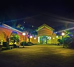
Lombard Plantation and the Lombard House is located on the Mississippi River in the Ninth Ward of New Orleans, Louisiana. Named for Joseph Lombard pere, the purchaser of the plot of land for his son, the tract of land was acquired October 25, 1825. In a series of transactions, the land was sold back to Lombard to improve the land for $7,500. He then sold the improved land back to his son, Joseph Guilaume, with the plantation house for $13,000; the 1825-1926 transaction records establish the value of the building was $5,500. The plantation property boundaries began with Mississippi River fronted property 96 acres (39 ha) (1.5 arpents) and 1.45 miles (2.33 km) (40 arpents) towards Lake Pontchartrain. The sale to Guilaume included a kitchen house, eight cows, two mules, carts, and two slaves. The Lombard family owned the plantation for less than a decade; the land and house was sold April 11, 1833 to Phillipe Guesnon for a lucrative sum of $50,000 (~$1.63 million in 2022) for unknown reasons. The grounds were split between the heirs. On January 20, 1835, the house and land were auctioned off to Frenchman Jean Louise Grasse; the bill of sale to Grease described the property as "une belle maison..." Grasse died March 1843 in debt, his widow renounced her succession of the plantation in order to pay off the debt. The Durands (property owners from 1843 to 1864) re-assembled the property and continued to use the plantation for commercial agriculture. Charles Caffin controlled the plantation from 1864 to 1880; during his tenure he added a cast iron cornstalk fence to the property, which lasted until the 1960s. In 1878, the building was auctioned, the parcel was subdivided again and within a decade shotgun houses were built within the property boundaries. In 1930, Heinrich Buthmann controlled the house as an art shop and residence. The next owner, Watkin Eschette, converted the basement into two rentals and sold off the backyard. In the mid to late 50s, the front yard was sold and developed as a cinder block bikers bar. In 2002, the bar and the lot were sold to the current owner, Frederick Starr. The bar was immediately demolished. After Hurricane Katrina, the owner was able to purchase the former backyard and reunited the immediate part of the property.
Excerpt from the Wikipedia article Lombard Plantation (License: CC BY-SA 3.0, Authors, Images).Lombard Plantation
Chartres Street, New Orleans
Geographical coordinates (GPS) Address Nearby Places Show on map
Geographical coordinates (GPS)
| Latitude | Longitude |
|---|---|
| N 29.9609 ° | E -90.037 ° |
Address
Chartres Street 3929
70117 New Orleans
Louisiana, United States
Open on Google Maps


