place

River Alport

Rivers and valleys of the Peak DistrictRivers of Derbyshire
AlportBridge
AlportBridge

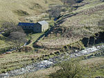
The River Alport flows for 5.6 miles (9 km) in the Dark Peak of the Peak District in Derbyshire, England. Its source is on Bleaklow, 3 miles (4.8 km) east of Glossop, from which it flows south through the Grains in the Water bog, then over gritstone below the Alport Castles landslide to Alport Bridge on the A57 Snake Pass route from Sheffield to Manchester, where it joins the River Ashop. The Ashop flows into Ladybower Reservoir about 2.5 miles (4.0 km) down the valley, which discharges via the Rivers Derwent and Trent to the North Sea. The source of the Alport is close to the Pennine watershed. The course of the river includes three small waterfalls. At its southern end lie the remains of a tunnel constructed to carry water to a planned but unbuilt cotton mill. A weir was built on the river in about 1922 and a short watercourse added to feed the water into the Ashop weir located upstream of the confluence. The water was then culverted along the valley to the Ashop Siphon near Hagg Farm, where it then crossed over the River Ashop in a 6-foot-diameter (1.8 m) steel pipe 273 yards (250 m) long, passed through a 1,065-yard (974 m) tunnel under the hill and then via another open watercourse of 761 yards (696 m) to discharge into the Derwent Reservoir a few yards north of the dam wall. The outlet is visible from the viewing area.The valley of the Alport contains some farmland, but the banks of the valley are mostly coniferous plantations and heath. The coniferous plantations are being converted to semi-natural deciduous woodland. The small hamlet of Alport lies on the west bank near the southern end of the river.

Excerpt from the Wikipedia article River Alport (License: CC BY-SA 3.0, Authors, Images).

River Alport
Snake Road, High Peak Hope Woodlands

Geographical coordinates (GPS) Address Nearby Places
placeShow on map

Wikipedia: River AlportContinue reading on Wikipedia

Geographical coordinates (GPS)

Latitude Longitude
N 53.4025 ° E -1.7886 °
placeShow on map

Address

Snake Road

Snake Road
S33 0AB High Peak, Hope Woodlands
England, United Kingdom
mapOpen on Google Maps

AlportBridge
AlportBridge
Share experience

Nearby Places

Dark Peak
Dark Peak

The Dark Peak is the higher and wilder part of the Peak District in England, mostly forming the northern section but also extending south into its eastern and western margins. It is mainly in Derbyshire but parts are in Staffordshire, Cheshire, Greater Manchester, West Yorkshire and South Yorkshire. It gets its name because (in contrast to the White Peak), the underlying limestone is covered by a cap of Millstone Grit sandstones with softer shale underneath, meaning that in winter the soil is almost always saturated with water. The land is thus largely uninhabited moorland plateaux where almost any depression is filled with sphagnum bogs and black peat. The High Peak is an alternative name for the Dark Peak, but High Peak is also the name of an administrative district of Derbyshire which includes part of the White Peak. The areas of Millstone Grit form an 'inverted horseshoe' around the lower uncapped limestone areas of the White Peak, enclosing it to the west, north and east. Hence the Dark Peak is said to cover the higher, northern moors between the Hope Valley to the south and the Tame Valley, Standedge and Holme Valley to the north, separating it from the South Pennines, the Western Moors stretching south to near the Churnet Valley, and the Eastern Moors southwards towards Matlock. The Dark Peak is one of 159 National Character Areas defined by Natural England; as defined by Natural England, the Dark Peak NCA covers 86,604 hectares (334 sq mi) and includes the northern block of hills approximately bounded by Marsden, Stocksbridge, Hathersage and Chapel-en-le-Frith, plus the eastern moors between Hathersage and Matlock, but excludes the western moors between Chapel and the Churnet Valley (which it places in NCA 53, the South West Peak), and the area around Glossop (in NCA 54, Manchester Pennine Fringe).An area of 31,852 hectares (123 sq mi) is designated as the Dark Peak Site of Special Scientific Interest (SSSI), which excludes the separately designated Eastern Moors. The SSSI extends over the borders into Greater Manchester and West Yorkshire. A large part of the SSSI is included in the South Pennine Moors Special Area of Conservation.Principal upland areas within the Dark Peak include Kinder Scout, Bleaklow (both of which rise to over 600 m (2,000 ft)), Black Hill, the Roaches, Shining Tor, Mam Tor, Win Hill and Stanage Edge.

Howden Reservoir
Howden Reservoir

The Howden Reservoir is a Y-shaped reservoir, the uppermost of the three in the Upper Derwent Valley, England. The western half of the reservoir lies in Derbyshire and the eastern half is in Sheffield, South Yorkshire; the county border runs through the middle of the reservoir, following the original path of the River Derwent. The longest arm is around 1+1⁄4 mi (2.0 km) in length. The reservoir is bounded at the southern end by Howden Dam; below this, the Derwent flows immediately into Derwent Reservoir and subsequently the Ladybower Reservoir. Other tributaries include the River Westend, Howden Clough and Linch Clough. Work commenced on the dam's construction on 16 July 1901 and completed in July 1912. The chief engineer was Edward Sandeman. He was also in charge of building nearby Derwent dam and was awarded the Telford Medal in 1918 for his work "Derwent Valley Waterworks". The works involved constructing a temporary village at Birchinlee, or "Tin Town", for the workers, a temporary railway line from the main line at Bamford, construction of a link aqueduct to the Derwent Dam. The dam is of solid masonry construction, and 117 ft (36 m) tall, 1,080 ft (330 m) long, and impounds 1,900,000 imp gal (8,600 kl) of water, from a catchment area of 5,155 acres (2,086 ha). The workers who died during the construction of the dam were buried in St John the Baptist's Church, Bamford. To the east of the reservoir stands Featherbed Moss, one of the highest tops in the area at 1,788 ft (545 m), and one of several tops of that name in the area. This is not to be confused with the more well-known Featherbed Moss on the Pennine Way between Kinder Scout and Bleaklow.