place

Great Ridge

Mountains and hills of DerbyshireMountains and hills of the Peak DistrictRidges of England
Great Ridge
Great Ridge

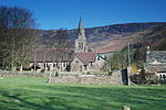
Great Ridge is a ridge separating the vales of Edale and Castleton in Derbyshire, England. It extends for approximately 3 kilometres (1.9 mi) from Mam Tor at the western end of the ridge to Lose Hill at the eastern end, the lowest point being Hollins Cross. A path runs along the length of the ridge, and is roughly paved to prevent erosion caused by the large number of visitors. The only steep section of the path is Back Tor, just east of Hollins Cross, which may not be suitable for the very infirm. West of Mam Tor, the high ground continues, slightly changing direction, as Rushup Edge. The ridge is featured in the 2018 racing video game Forza Horizon 4 as part of the game's world.

Excerpt from the Wikipedia article Great Ridge (License: CC BY-SA 3.0, Authors, Images).

Great Ridge
Mam Tor Road, High Peak Castleton

Geographical coordinates (GPS) Address Nearby Places
placeShow on map

Wikipedia: Great RidgeContinue reading on Wikipedia

Geographical coordinates (GPS)

Latitude Longitude
N 53.3574 ° E -1.7972 °
placeShow on map

Address

Tom Hyett

Mam Tor Road
S33 8WA High Peak, Castleton
England, United Kingdom
mapOpen on Google Maps

Great Ridge
Great Ridge
Share experience

Nearby Places

Speedwell Cavern
Speedwell Cavern

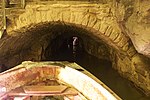
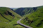
Speedwell Cavern is one of the four show caves in Castleton, Derbyshire, England.The cave system consists of a horizontal lead miners' adit (a level passageway driven horizontally into the hillside) 200 metres (660 ft) below ground leading to the cavern itself, a limestone cave. The narrow adit is permanently flooded, so after descending a long staircase, access to the cave is made by boat. At the end of the adit, the cavern opens up with fluorspar veins, stalactites and stalagmites, and the so-called "Bottomless Pit". This chamber has an underground lake with a 20 metres (66 ft) high waterfall and an extremely deep vertical shaft, now choked to within 20 metres (66 ft) of the surface by rock spoil dumped by miners, after driving the continuation of the canal to the natural streamway beyond, which provided the bulk of the water for the canal. The original depth of the shaft has been estimated, from the amount of spoil placed in the shaft over the years, at around 150 metres (490 ft).The mine was developed in the 1770s but the limited lead ore deposits meant that it was not profitable and it was closed down by 1790.At the foot of Winnats Pass, it is a tourist attraction with an underground boat trip to the cavern. Originally the guide propelled the boat by pushing against the walls with his hands, later the boat was legged through, and now it is powered by an electric motor. A connection was discovered in 2006 between the Speedwell Cavern system and Titan, the largest natural shaft in the UK, which is 141.5 metres (464 ft) high.