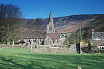
Edale railway station
DfT Category F2 stationsFormer Midland Railway stationsNorthern franchise railway stationsRailway stations in DerbyshireRailway stations in Great Britain opened in 1894 ... and 2 more
Railway stations served by East Midlands RailwayUse British English from March 2015

Edale railway station serves the rural village of Edale in the Derbyshire Peak District, in England. It is located 20 miles (32 km) west of Sheffield and 22 miles (35 km) east of Manchester Piccadilly. The station was opened in 1894 on the Midland Railway's Dore and Chinley line, now known as the Hope Valley Line. Lying below Kinder Scout, the station is about 5 minutes' walk from the centre of the village, where the Pennine Way begins; the Nags Head public house is known as the official starting point.
Excerpt from the Wikipedia article Edale railway station (License: CC BY-SA 3.0, Authors, Images).Edale railway station
High Peak Edale
Geographical coordinates (GPS) Address Nearby Places Show on map
Geographical coordinates (GPS)
| Latitude | Longitude |
|---|---|
| N 53.36443 ° | E -1.81663 ° |
Address
S33 7ZP High Peak, Edale
England, United Kingdom
Open on Google Maps


