place

Hollins Cross

Mountains and hills of DerbyshireMountains and hills of the Peak District
Path down to Hollins Cross and up to Mam Tor (geograph 2828182)

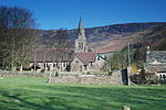
Hollins Cross lies between Mam Tor and Lose Hill on the Great Ridge that separates Castleton and Edale in Derbyshire, England. Hollins Cross is the lowest point on the ridge and is therefore a popular route taken by walkers wishing either to cross from one side to the other, or to start a walk along the ridge. It was also the traditional route from Castleton to Edale. Coffins from Edale were taken over Hollins Cross to Hope church until a church was constructed in Edale, leading to the nickname of the "coffin road" for this route.There are three well-used paths on both sides of the ridge leading to Hollins Cross. The path west of Hollins Cross is a gentle climb on a paved path of around one kilometre to the summit of Mam Tor. The path east is slightly more taxing with the initial climb up Back Tor being unpaved and badly eroded. Beyond Back Tor the path continues on to Lose Hill on a paved surface. Hollins Cross is named for an actual cross that was raised here, but which had disappeared by 1905. A memorial to Tom Hyett (formerly surmounted by a topograph) was erected by the Long Eaton and District Group of the Ramblers Association in 1964.

Excerpt from the Wikipedia article Hollins Cross (License: CC BY-SA 3.0, Authors, Images).

Hollins Cross
Mam Tor Road, High Peak Castleton

Geographical coordinates (GPS) Address Nearby Places
placeShow on map

Wikipedia: Hollins CrossContinue reading on Wikipedia

Geographical coordinates (GPS)

Latitude Longitude
N 53.357 ° E -1.797 °
placeShow on map

Address

Tom Hyett

Mam Tor Road
S33 8WA High Peak, Castleton
England, United Kingdom
mapOpen on Google Maps

Path down to Hollins Cross and up to Mam Tor (geograph 2828182)
Share experience

Nearby Places

Speedwell Cavern
Speedwell Cavern

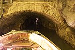
Speedwell Cavern is one of the four show caves in Castleton, Derbyshire, England.The cave system consists of a horizontal lead miners' adit (a level passageway driven horizontally into the hillside) 200 metres (660 ft) below ground leading to the cavern itself, a limestone cave. The narrow adit is permanently flooded, so after descending a long staircase, access to the cave is made by boat. At the end of the adit, the cavern opens up with fluorspar veins, stalactites and stalagmites, and the so-called "Bottomless Pit". This chamber has an underground lake with a 20 metres (66 ft) high waterfall and an extremely deep vertical shaft, now choked to within 20 metres (66 ft) of the surface by rock spoil dumped by miners, after driving the continuation of the canal to the natural streamway beyond, which provided the bulk of the water for the canal. The original depth of the shaft has been estimated, from the amount of spoil placed in the shaft over the years, at around 150 metres (490 ft).The mine was developed in the 1770s but the limited lead ore deposits meant that it was not profitable and it was closed down by 1790.At the foot of Winnats Pass, it is a tourist attraction with an underground boat trip to the cavern. Originally the guide propelled the boat by pushing against the walls with his hands, later the boat was legged through, and now it is powered by an electric motor. A connection was discovered in 2006 between the Speedwell Cavern system and Titan, the largest natural shaft in the UK, which is 141.5 metres (464 ft) high.