Loch Long

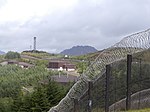
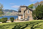
Loch Long is a body of water in the council area of Argyll and Bute, Scotland. The Sea Loch extends from the Firth of Clyde at its southwestern end. It measures approximately 20 miles (30 kilometres) in length, with a width of between one and two miles (two and three kilometres). The loch also has an arm, Loch Goil, on its western side. Its name is not a reference to is length; it actually comes from the Gaelic for "ship lake". Prior to their defeat at the Battle of Largs in 1263, Viking raiders sailed up Loch Long to Arrochar, and then dragged their longships 2 miles overland to Tarbet and into Loch Lomond. Being inland, the settlements around Loch Lomond were more vulnerable to attack.Loch Long forms part of the coast of the Cowal peninsula, and forms the entire western coastline of the Rosneath Peninsula. Loch Long was historically the boundary between Argyll and Dunbartonshire; however, boundary redrawing in 1996 bmeant that it moved wholly within the council area of Argyll and Bute. The steamboat Chancellor used to traverse the loch, departing Dunoon at 11:00 and returning about five hours later. PS Waverley was also built to serve Loch Long and Loch Goil from 1947, a route that she still sailed as of 2021, albeit as more of an attraction than a primary means of transport.
Excerpt from the Wikipedia article Loch Long (License: CC BY-SA 3.0, Authors, Images).Loch Long
Geographical coordinates (GPS) Address Nearby Places Show on map
Geographical coordinates (GPS)
| Latitude | Longitude |
|---|---|
| N 56.034395 ° | E -4.8855839 ° |
Address
Milnavoullin
G84 0PD
Scotland, United Kingdom
Open on Google Maps


