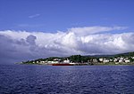
Blairmore, Argyll
Argyll and Bute geography stubsFirth of ClydeHighlands and Islands of ScotlandVillages in Cowal

Blairmore is a village located on the Cowal peninsula in Argyll and Bute, Scotland. Blairmore lies within the Loch Lomond and The Trossachs National Park. It is situated on the western shore of Loch Long and around 1 mile (1.6 km) north of Strone. The village was largely built during the Victorian era and has a small wooden pier which dates to 1855.
Excerpt from the Wikipedia article Blairmore, Argyll (License: CC BY-SA 3.0, Authors, Images).Blairmore, Argyll
High Road,
Geographical coordinates (GPS) Address Nearby Places Show on map
Geographical coordinates (GPS)
| Latitude | Longitude |
|---|---|
| N 56.00126 ° | E -4.9009824 ° |
Address
High Road
High Road
PA23 8TH
Scotland, United Kingdom
Open on Google Maps


