Freeman's Common
Borough of Bedford
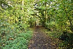
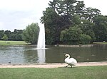
Freeman's Common is a 12.5 hectare area of land situated to the north of Bedford, in the parish of Ravensden. It was created in 1858. Over many years it has been the focus of local dispute as to whether the site should be developed. Despite the name, it is not in fact registered as common land.
Excerpt from the Wikipedia article Freeman's Common (License: CC BY-SA 3.0, Authors).Freeman's Common
Douglas Road,
Geographical coordinates (GPS) Address Nearby Places Show on map
Geographical coordinates (GPS)
| Latitude | Longitude |
|---|---|
| N 52.16738 ° | E -0.45208 ° |
Address
Douglas Road
Douglas Road
MK41 7YF , Brickhill
England, United Kingdom
Open on Google Maps


