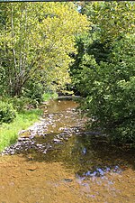
Shamokin Creek

Shamokin Creek (also known as Great Shamokin Creek or Middle Branch Shamokin Creek) is a tributary of the Susquehanna River in Northumberland County, Pennsylvania, in the United States. It is approximately 32.4 miles (52.1 km) long and flows through Mount Carmel, Mount Carmel Township, Coal Township, Shamokin, Ralpho Township, Shamokin Township, Snydertown, Upper Augusta Township, and Sunbury. The watershed of the creek has an area of 137 square miles (350 km2). It experiences significant impacts by abandoned mine drainage and many abandoned mine drainage discharges are in its watershed. Various other impairments also affect parts of the creek's watershed. Shamokin Creek is in the Appalachian Mountains section of the Ridge and Valley physiographic province. Rock formations consisting of sandstone, shale, and anthracite deposits occur in the watershed. The main land uses in the watershed of Shamokin Creek are forested land and agricultural land, with barren land and urban land making up only a few percent of the watershed. However, in the upper 54 square miles (140 km2), forested land and mine spoils dominate, urban land is less prevalent, and agricultural land is virtually nonexistent. Coal mining was being done in the watershed of Shamokin Creek by the early 1800s. In the early 1900s, coal mining, foundries, iron works, nail production, agriculture, silk mills, and woolen mills were the main industries in the watershed. In the 1990s and 2000s, many grants for restoring the creek have been received by various organizations. The main stem of Shamokin Creek is designated as a Warmwater Fishery and a Migratory Fishery. The creek is devoid of fish life in its upper reaches, but several fish species have been observed further downstream. The upper reaches of the creek also lack macroinvertebrate life. The lower 21.6 miles (34.8 km) of the creek are navigable by canoe for part of the year. Pennsylvania State Game Lands Number 165 is also partially in the watershed.
Excerpt from the Wikipedia article Shamokin Creek (License: CC BY-SA 3.0, Authors, Images).Shamokin Creek
PA 147, Upper Augusta Township
Geographical coordinates (GPS) Address Nearby Places Show on map
Geographical coordinates (GPS)
| Latitude | Longitude |
|---|---|
| N 40.8419 ° | E -76.8058 ° |
Address
PA 147
17876 Upper Augusta Township
Pennsylvania, United States
Open on Google Maps


